File:Scandinavia complectens Sueciæ, Daniæ et Norvegiæ regna – ex tabulis - Kungliga Biblioteket - 10348309-thumb.png

Original file (10,126 × 7,774 pixels, file size: 380.77 MB, MIME type: image/png)
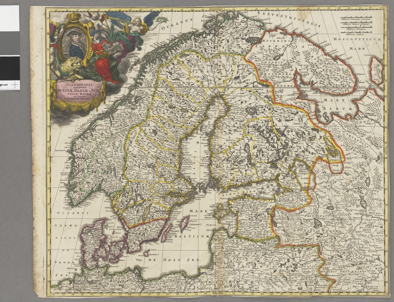
Captions
Captions
| Title |
|
||||||||||||||||||||||||||
| Description |
Svenska: Schematisk topografi. - Landskapsgränser. - Städer och byar utsatta. - Kartusch med Karl XII |
||||||||||||||||||||||||||
| Source |
|
||||||||||||||||||||||||||
| Creator |
Johann Baptist Homann (1664-1724; creator, cartographer) |
||||||||||||||||||||||||||
| Permission (Reusing this file) |
Per the source the digitisations are under
|
||||||||||||||||||||||||||
| Geotemporal data | |||||||||||||||||||||||||||
| Map location |
Svenska: Skandinavien |
||||||||||||||||||||||||||
| Scale | 1:4,300,000 | ||||||||||||||||||||||||||
| Bounding box |
|
||||||||||||||||||||||||||
| Georeferencing | If inappropriate please set warp_status = skip to hide. | ||||||||||||||||||||||||||
| Bibliographic data | |||||||||||||||||||||||||||
| Map sheet | 1 karta | ||||||||||||||||||||||||||
| Language | Latin | ||||||||||||||||||||||||||
| Publisher |
Unknown, Nürnberg, Germany |
||||||||||||||||||||||||||
| Archival data | |||||||||||||||||||||||||||
| Collection |
|
||||||||||||||||||||||||||
| Accession number |
10348309 |
||||||||||||||||||||||||||
| Dimensions | 47 x 56 cm | ||||||||||||||||||||||||||
| Medium | kopparstick | ||||||||||||||||||||||||||
| Notes |
Ioh. Babtista Homanni
|
||||||||||||||||||||||||||
| Other versions |
|
||||||||||||||||||||||||||

File history
Click on a date/time to view the file as it appeared at that time.
| Date/Time | Thumbnail | Dimensions | User | Comment | |
|---|---|---|---|---|---|
| current | 00:24, 22 January 2015 | | 10,126 × 7,774 (380.77 MB) | L PBot (talk | contribs) | {{subst:User:André_Costa_(WMSE)/KB-map |title = * Scandinavia complectens Sueciæ, Daniæ et Norvegiæ regna – ex tabulis * Scandinavia complectens Sveciæ, Daniæ et Norvegiæ regna |description = {{sv|Schematisk topografi. - Landsk... |
You cannot overwrite this file.
File usage on Commons
The following 3 pages use this file: