File:Schönebeck-Frohse, Preußischer Rundsockelstein (1).jpg

Size of this preview: 800 × 600 pixels. Other resolutions: 320 × 240 pixels | 640 × 480 pixels | 1,024 × 768 pixels | 1,280 × 960 pixels | 2,048 × 1,536 pixels.
Original file (2,048 × 1,536 pixels, file size: 856 KB, MIME type: image/jpeg)
Captions
Captions
Add a one-line explanation of what this file represents
Summary edit
.jpg&action=edit§ion=1)
| Description |
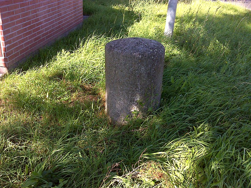
Deutsch: Schönebeck-Frohse, L 51, Geschwister-Scholl-Straße / Alt Frohse an einem Fußweg vor Hausnummer 71, westliche Straßenseite vor einer Trafostation
|
| Date | Taken on 17 September 2023, 14:07:39 |
| Source | Self-photographed |
| Author | Manfred Schröter, Berga |
| Camera location | | View this and other nearby images on: OpenStreetMap |
|---|
.jpg¶ms=052.029247_N_0011.716103_E_globe:Earth_type:camera_heading:343.48&language=en)
Licensing edit
.jpg&action=edit§ion=2)
Manfred Schröter, Berga, the copyright holder of this work, hereby publishes it under the following license:
This file is licensed under the Creative Commons Attribution-Share Alike 4.0 International license.
Attribution: Manfred Schröter, Berga
- You are free:
- to share – to copy, distribute and transmit the work
- to remix – to adapt the work
- Under the following conditions:
- attribution – You must give appropriate credit, provide a link to the license, and indicate if changes were made. You may do so in any reasonable manner, but not in any way that suggests the licensor endorses you or your use.
- share alike – If you remix, transform, or build upon the material, you must distribute your contributions under the same or compatible license as the original.

|
This image was uploaded as part of Wiki Loves Monuments 2023.
|
File history
Click on a date/time to view the file as it appeared at that time.
| Date/Time | Thumbnail | Dimensions | User | Comment | |
|---|---|---|---|---|---|
| current | 19:19, 23 September 2023 | | 2,048 × 1,536 (856 KB) | Manfred Schröter, Berga (talk | contribs) | == {{int:filedesc}} == {{Information |description={{de|1=Schönebeck-Frohse, L 51, Geschwister-Scholl-Straße/Alt Frohse auf Fußweg vor Hausnummer 71, westliche Straßenseite vor Trafostation * preußischer Rundsockelstein, Ganzmeilenstein * Chausseemeilenstein, um 1858 * vermutlich 2 Meilen von de:Magdeburg entfernt }} |date={{taken on|location=Saxony-Anhalt|2023-09-17 14:07:39}} |source={{own pho... |
You cannot overwrite this file.
File usage on Commons
The following page uses this file:
.jpg&oldid=824016852)