File:Schönheide Blick auf Ortsteile Webersberg (links oben), Ziegenleithe (Häuserreihe an ansteigendem Weg) und Tal des Filzbachs Ansichtskarte von etwa 1905.jpg
Size of this preview: 800 × 499 pixels. Other resolutions: 320 × 200 pixels | 640 × 399 pixels | 1,024 × 639 pixels | 1,280 × 798 pixels | 2,560 × 1,597 pixels | 4,458 × 2,781 pixels.
Original file (4,458 × 2,781 pixels, file size: 5.31 MB, MIME type: image/jpeg)
Captions
Captions
Add a one-line explanation of what this file represents
Summary
edit,_Ziegenleithe_(H%C3%A4userreihe_an_ansteigendem_Weg)_und_Tal_des_Filzbachs_Ansichtskarte_von_etwa_1905.jpg&action=edit§ion=1)
| Description |
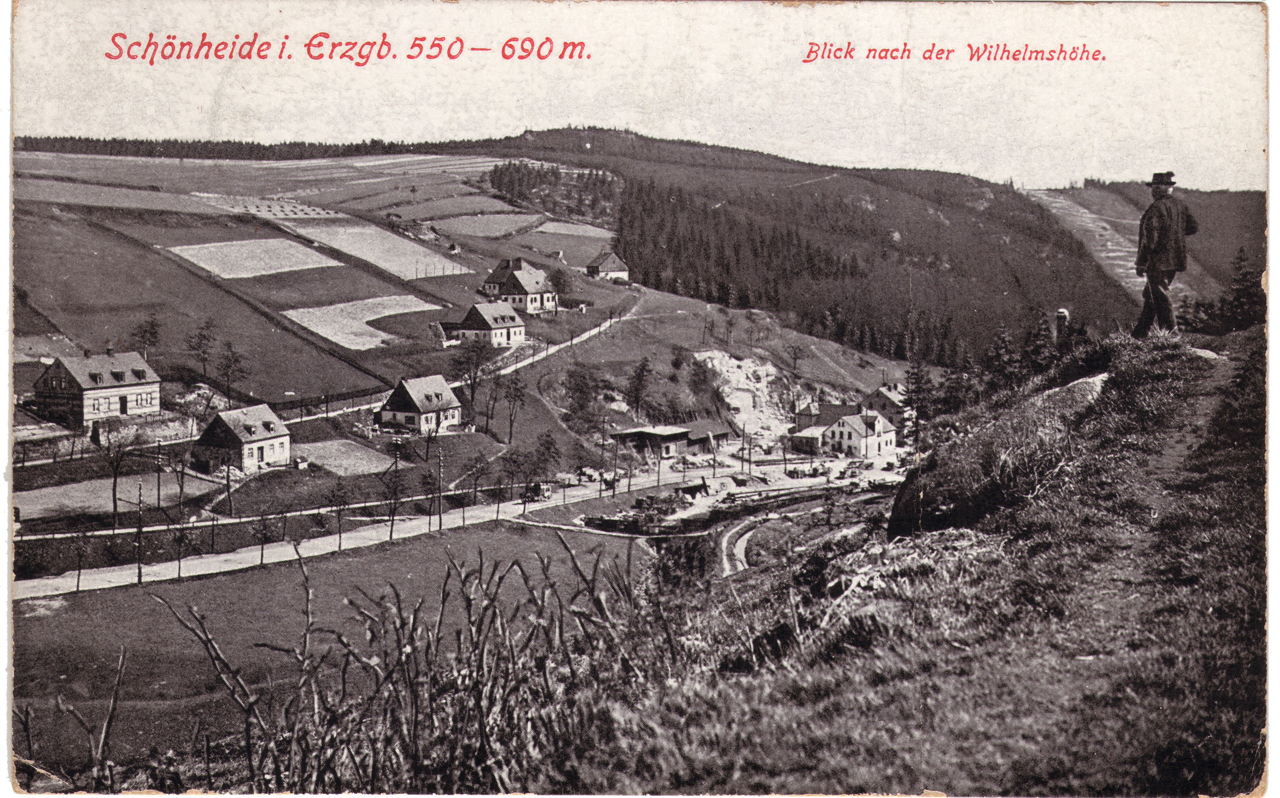
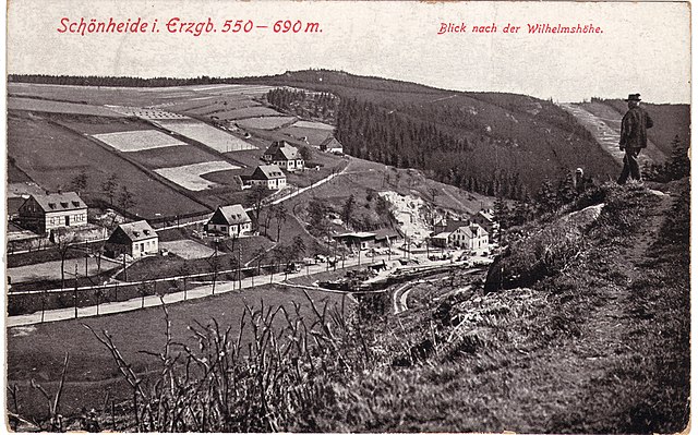
Deutsch: Schönheide: Blick auf Ortsteile Webersberg (links oben) und Ziegenleithe (Häuserreihe an ansteigendem Weg) sowie das Tal des Filzbachs mit nach Schönheiderhammer führender Eibenstocker Straße, Ansichtskarte von etwa 1905. Unterhalb der Häuserreihe war das Stollenmundloch des Kupferbergwerkes, das von etwa 1560 bis um 1800 betrieben wurde. |
| Date | circa 1905 |
| Source | Scan of a postcard |
| Author | Unknown author |
| Permission (Reusing this file) |
This image is in the public domain due to its age. |
Licensing
edit,_Ziegenleithe_(H%C3%A4userreihe_an_ansteigendem_Weg)_und_Tal_des_Filzbachs_Ansichtskarte_von_etwa_1905.jpg&action=edit§ion=2)
|
This work is in the public domain in its country of origin and other countries and areas where the copyright term is the author's life plus 70 years or fewer. This work is in the public domain in the United States because it was published (or registered with the U.S. Copyright Office) before January 1, 1929. | |
| This file has been identified as being free of known restrictions under copyright law, including all related and neighboring rights. | |
File history
Click on a date/time to view the file as it appeared at that time.
| Date/Time | Thumbnail | Dimensions | User | Comment | |
|---|---|---|---|---|---|
| current | 09:09, 3 September 2019 | | 4,458 × 2,781 (5.31 MB) | Klaaschwotzer (talk | contribs) | {{Information |description ={{de|1=Schönheide: Blick auf Ortsteile Webersberg (links oben) und Ziegenleithe (Häuserreihe an ansteigendem Weg) sowie das Tal des Filzbachs mit nach Schönheiderhammer führender Eibenstocker Straße, Ansichtskarte von etwa 1905. Unterhalb der Häuserreihe war das Stollenmundloch des Kupferbergwerkes, das von etwa 1560 bis um 1800 betrieben wurde.}} |date... |
You cannot overwrite this file.
File usage on Commons
There are no pages that use this file.
File usage on other wikis
The following other wikis use this file:
- Usage on de.wikipedia.org
,_Ziegenleithe_(Häuserreihe_an_ansteigendem_Weg)_und_Tal_des_Filzbachs_Ansichtskarte_von_etwa_1905.jpg&oldid=714267888)