File:Schematic map of the Orenburg region.png
No higher resolution available.
Schematic_map_of_the_Orenburg_region.png (400 × 265 pixels, file size: 30 KB, MIME type: image/png)
Captions
Captions
Add a one-line explanation of what this file represents
Summary
edit
| Description |
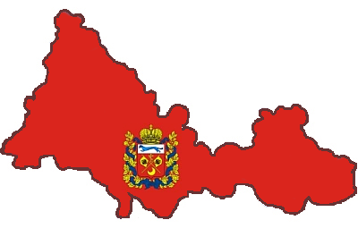
English: orenburg region
Русский: Оренбург |
| Date | |
| Source | своя работа |
| Author | velesss |
Licensing
edit
I, the copyright holder of this work, hereby publish it under the following license:
This file is licensed under the Creative Commons Attribution-Share Alike 3.0 Unported license.
- You are free:
- to share – to copy, distribute and transmit the work
- to remix – to adapt the work
- Under the following conditions:
- attribution – You must give appropriate credit, provide a link to the license, and indicate if changes were made. You may do so in any reasonable manner, but not in any way that suggests the licensor endorses you or your use.
- share alike – If you remix, transform, or build upon the material, you must distribute your contributions under the same or compatible license as the original.
File history
Click on a date/time to view the file as it appeared at that time.
| Date/Time | Thumbnail | Dimensions | User | Comment | |
|---|---|---|---|---|---|
| current | 18:07, 30 October 2011 | | 400 × 265 (30 KB) | Sealle (talk | contribs) | Корректные очертания области |
| 22:50, 22 January 2011 |  | 241 × 241 (27 KB) | Velesss (talk | contribs) | {{Information |Description ={{en|1=orenburg region}} {{ru|1=Оренбург}} |Source =своя работа |Author =velesss |Date =22 января 2011 |Permission = |other_versions = }} |
You cannot overwrite this file.
File usage on Commons
There are no pages that use this file.
File usage on other wikis
The following other wikis use this file:
- Usage on ce.wikipedia.org
- Борискино (Матвеевкан кӀошт)
- Артамоновка (Абдулинан кӀошт)
- Кеп:Orenb-obl-geo-stub
- Абдрахманово (Абдулинан кӀошт)
- Алексеевка (Абдулинан кӀошт)
- Алфёровка (Оренбурган область)
- Андреевка (Абдулинан кӀошт)
- Аркаевка
- Артемьевка (Оренбурган область)
- Баклановка (Абдулинан кӀошт)
- Большой Сурмет
- Булатовка (Абдулинан кӀошт)
- Васильевка (Абдулинан кӀошт)
- Васькино (Абдулинан кӀошт)
- Верхни Курмей
- Гавриловка (Абдулинан кӀошт)
- Даниловка (Абдулинан кӀошт)
- Егорьевка (Абдулинан кӀошт)
- Емантаево
- Зерикла
- Зоровка (Оренбурган область)
- Исайкино
- Камыш-Садак
- Лесной (Абдулинан кӀошт)
- Мали Сурмет
- Венера (Абдулинан кӀошт)
- Нижни Курмей
- Николькино
- Новотроевка (Абдулинан кӀошт)
- Нови Тирис
- Первомайски (Абдулинан кӀошт)
- Петровка (Абдулинан кӀошт)
- Покровка (Абдулинан кӀошт)
- Радовка (Абдулинан кӀошт)
- Савельевка (Абдулинан кӀошт)
- Северни Звезда
- Старые Шалты
- Степановка Втори
- Степановка Перви
- Тирис (разъезд)
- Тирис-Усманово
- Чемизла
- Чеганлы (Абдулинан кӀошт)
- Новоякупово (Абдулинан кӀошт)
- Красни Нива (Абдулинан кӀошт)
- Искра (Абдулинан кӀошт)
- Захаркино (Абдулинан кӀошт)
- Яковлевка (Абдулинан кӀошт)
- Абдулино
- 435 км (разъезд)
View more global usage of this file.