File:Schneeberg und Rosenthal, 1757 - saxony.jpg

Size of this preview: 710 × 600 pixels. Other resolutions: 284 × 240 pixels | 568 × 480 pixels | 909 × 768 pixels | 1,213 × 1,024 pixels | 2,425 × 2,048 pixels | 2,747 × 2,320 pixels.
Original file (2,747 × 2,320 pixels, file size: 1.72 MB, MIME type: image/jpeg)
Captions
Captions
Add a one-line explanation of what this file represents
Summary edit
| Description |
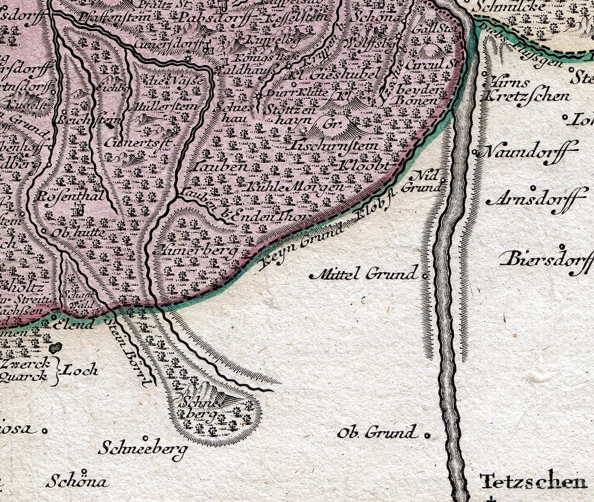
Neuer Sächsischer Atlas, 1760: Kt. 20: Karte vom Erzgebirgischen Kreis im Kurfürstentum Sachsen, etwa 1 : 120 000, Kupferstich, 1757 Carte von Ertzgebürgischen Creysse in Churfürstenthum Sachssen mit allen derinnen befindlichen Aembtern und Herrschafften wie solche eingetheilet und zwart. |
||||
| Date | |||||
| Source | Scan (Ausschnitt der Karte) | ||||
| Author | Adam Friedrich Zürner (Entw.), Peter Schenk (Stich) | ||||
| Permission (Reusing this file) |
|
||||
Digitalisat SLUB (anderes Objekt)
File history
Click on a date/time to view the file as it appeared at that time.
| Date/Time | Thumbnail | Dimensions | User | Comment | |
|---|---|---|---|---|---|
| current | 21:41, 15 March 2021 | | 2,747 × 2,320 (1.72 MB) | Lysippos (talk | contribs) | {{Information |Description=Neuer Sächsischer Atlas, 1760: Kt. 20: Karte vom Erzgebirgischen Kreis im Kurfürstentum Sachsen, etwa 1 : 120 000, Kupferstich, 1757 ''Carte von Ertzgebürgischen Creysse in Churfürstenthum Sachssen mit allen derinnen befindlichen Aembtern und Herrschafften wie solche eingetheilet und zwart.'' |Source= Scan (Ausschnitt der Karte) |Date= 1757 |Author= Adam Friedrich Zürner (Entw.), Peter Schenk (Stich) |P... |
You cannot overwrite this file.
File usage on Commons
There are no pages that use this file.
File usage on other wikis
The following other wikis use this file:
- Usage on de.wikipedia.org