File:Schwaebischer-Vulkan aerial Maar-Schlottrichter Zainingen Schwaebische-Alb.jpg

Size of this preview: 800 × 533 pixels. Other resolutions: 320 × 213 pixels | 640 × 427 pixels | 1,024 × 683 pixels | 1,280 × 853 pixels | 1,800 × 1,200 pixels.
Original file (1,800 × 1,200 pixels, file size: 2.11 MB, MIME type: image/jpeg)
Captions
Captions
Add a one-line explanation of what this file represents
Summary edit
| Description |
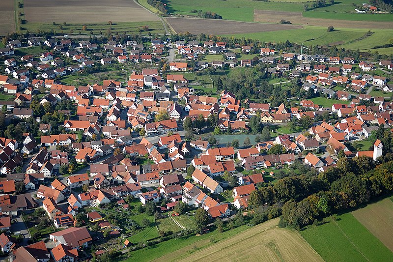
Deutsch: Luftbild von Zainingen (Gemeinde Römerstein), Mittlere Schwäbische Alb, 13km östlich von Bad Urach. Die meisten Vulkantrichter (ehemals zumeist Maare) des Schwäbischen Vulkans sind wie die übrigen jurassischen Sedimentschichten im Laufe von mehreren Mio. Jahren seit der miozänen Entstehung der Vulkane bis zu 200m verwittert und abgetragen worden. Die Trichter sind heute sanfte Mulden, die auf dem Plateau der Alb morphologisch noch gut erkennbar blieben. Weil das Schlotgestein der Muldenböden im Gegensatz zum Kalkgestein der Umgebung für Wasser undurchlässig ist – die Anwohner sprechen von „Wassersstein“ - wurden diese Mulden bevorzugt besiedelt, denn hier halfen kleine Karstquellen, Brunnen oder Tümpel Wasserknappheit teilweise zu kompensieren. Ein gutes Beispiel ist das ehemals kleine Dorf Zainingen. Die Häuser ducken sich auch heute noch kompakt in die Mulde und in den tiefsten Punkten sammelte sich das Wasser in drei so genannten Hülen, von denen eine noch erhalten ist und als ästhetischer Mittelpunkt des Ortes dient. English: Aerial of the settlement Zainingen, part of the municipality Römerstein, Middle Swabian Alb. Zainingen is an old settlement in a small depression on the Alb’s plateau. The small depression is the relict of a maar, low-relief of a volcanic crater of the type phreatomagmatic eruption. In several million years since the first volcanic eruption in Miocene the Upper Jurassic strata of the plateau weathered up to 200m - accordingly the maar relief - yet this is morphologically still distinctively visible. While the environment is karstic, the volcanic rock at the base of the low is impermeable. Early settlements on the Alb favored such lows for their availability of water from small karst springs or natural pools, which collected the water at the deepest points, respectively. One of three pools survived and is now the esthetical center of the community. |
| Date | |
| Source | Own work |
| Author | Reiner Enkelmann |
| Permission (Reusing this file) |
explicit permission for the uploader by Email, 14th December 2015 |
Licensing edit
This file is licensed under the Creative Commons Attribution-Share Alike 3.0 Germany license.
- You are free:
- to share – to copy, distribute and transmit the work
- to remix – to adapt the work
- Under the following conditions:
- attribution – You must give appropriate credit, provide a link to the license, and indicate if changes were made. You may do so in any reasonable manner, but not in any way that suggests the licensor endorses you or your use.
- share alike – If you remix, transform, or build upon the material, you must distribute your contributions under the same or compatible license as the original.

File history
Click on a date/time to view the file as it appeared at that time.
| Date/Time | Thumbnail | Dimensions | User | Comment | |
|---|---|---|---|---|---|
| current | 22:45, 19 January 2016 | | 1,800 × 1,200 (2.11 MB) | Ustill (talk | contribs) | User created page with UploadWizard |
You cannot overwrite this file.
File usage on Commons
There are no pages that use this file.
File usage on other wikis
The following other wikis use this file:
- Usage on de.wikipedia.org