File:Sebastian Münster - Map 18 Northern Europe - 1545.jpg

Size of this preview: 796 × 600 pixels. Other resolutions: 319 × 240 pixels | 637 × 480 pixels | 1,019 × 768 pixels | 1,280 × 964 pixels | 2,560 × 1,929 pixels | 4,222 × 3,181 pixels.
Original file (4,222 × 3,181 pixels, file size: 1.93 MB, MIME type: image/jpeg)
Captions
Captions
Add a one-line explanation of what this file represents
Summary edit
| Artist |
Sebastian Münster |
| Author |
Ptolemy |
| Description |
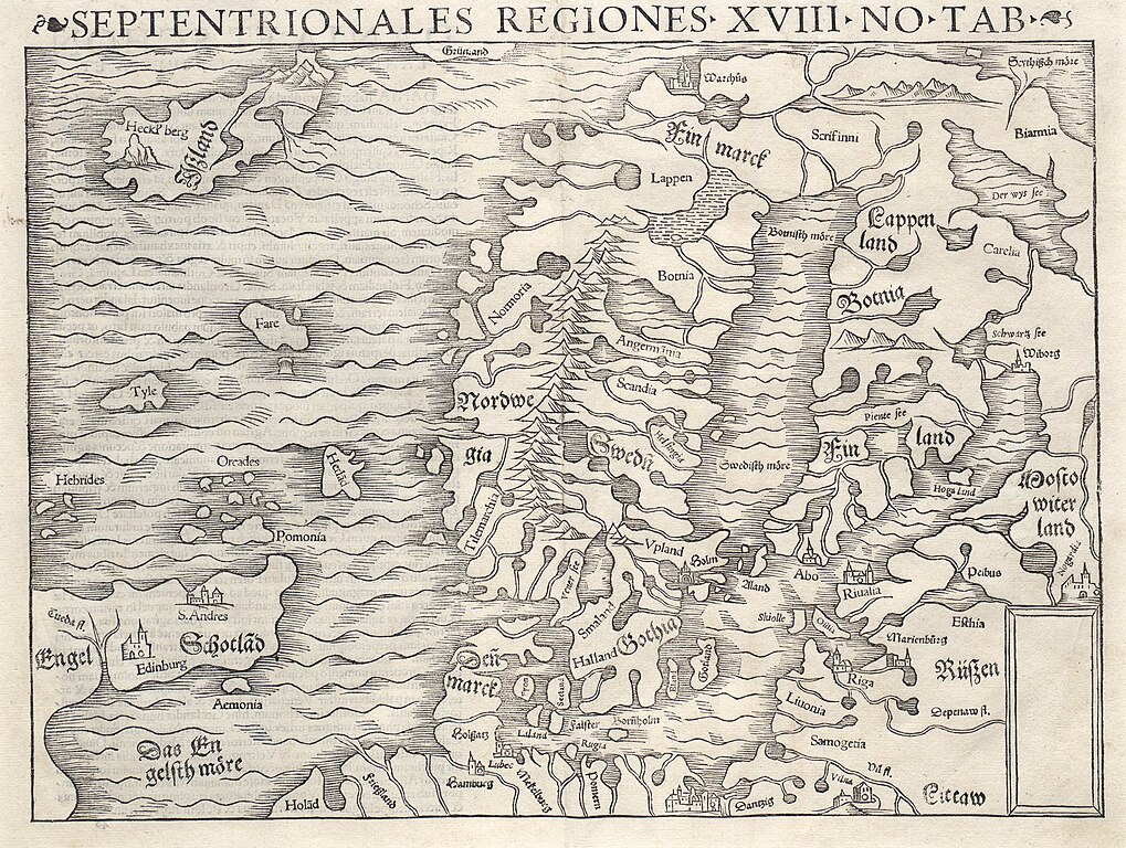
English: The Northern Regions, Map #18, an extra-Ptolemaic map of northern Europe from Sebastian Muenster's Cosmographia. Displays among other things: Lithuania, Biarmia, ... Français : Carte de l'Islande vers 1545 par Sebastian Münster. Latina: Septentrionales Regiones .XVIII. No. Tab. |
| Date | 1545 |
| Source/Photographer | http://islandskort.is/en/map/show/575 |
| Other versions |
|


Licensing edit
|
This is a faithful photographic reproduction of a two-dimensional, public domain work of art. The work of art itself is in the public domain for the following reason:
The official position taken by the Wikimedia Foundation is that "faithful reproductions of two-dimensional public domain works of art are public domain".
This photographic reproduction is therefore also considered to be in the public domain in the United States. In other jurisdictions, re-use of this content may be restricted; see Reuse of PD-Art photographs for details. | ||||
File history
Click on a date/time to view the file as it appeared at that time.
| Date/Time | Thumbnail | Dimensions | User | Comment | |
|---|---|---|---|---|---|
| current | 12:28, 27 February 2015 | | 4,222 × 3,181 (1.93 MB) | Thesupermat (talk | contribs) | User created page with UploadWizard |
You cannot overwrite this file.
File usage on Commons
The following 7 pages use this file: