File:Secunda Europae Tabula.jpg
Size of this preview: 791 × 599 pixels. Other resolutions: 317 × 240 pixels | 634 × 480 pixels | 1,014 × 768 pixels | 1,280 × 970 pixels | 2,560 × 1,940 pixels | 4,723 × 3,579 pixels.
Original file (4,723 × 3,579 pixels, file size: 2.56 MB, MIME type: image/jpeg)
Captions
Captions
Add a one-line explanation of what this file represents
Summary
edit| Description |
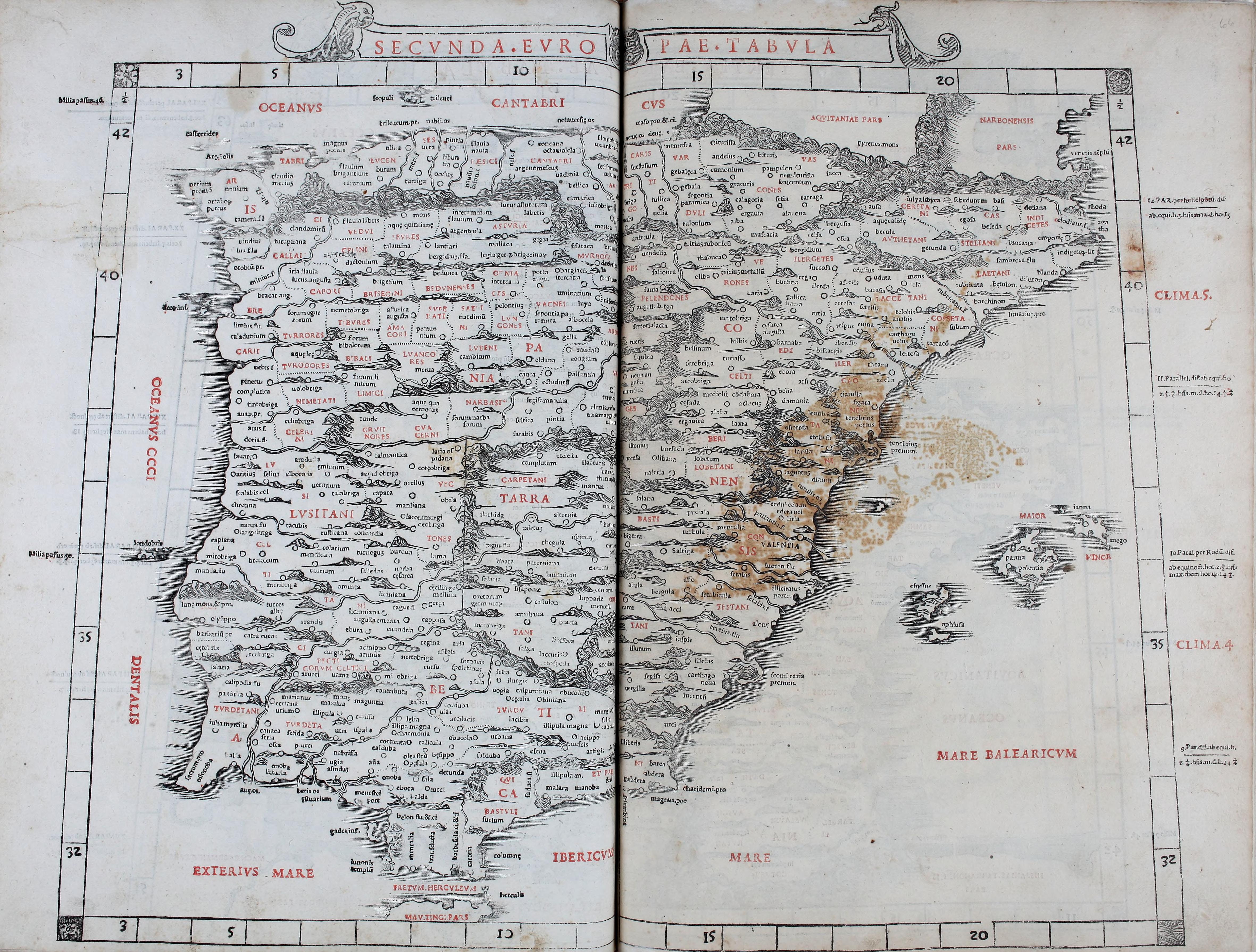
English: The second European map, depicting Roman Spain, from the 1511 Venetian edition of Ptolemy's Geography, edited by Bernardus Sylvanus Evoliensis (Bernardo da Silva of Eboli )and published by Jacobus Pentius de Leucho (Jacopo Pencio of Leccho).
Latina: In secunda Tabula Ispaniarum scilicet Bectica nunc Granatae Lusitania/portugalia Tarraconensis/Katalonia |
| Date | |
| Source | Claudius Ptolemaeus's Book on Geography |
| Author | Ptolemy |
| Other versions |
|
.jpg)
,_por_Bernardus_Sylvanus.jpg)
.jpg)
Licensing
edit
|
This work is in the public domain in its country of origin and other countries and areas where the copyright term is the author's life plus 70 years or fewer. This work is in the public domain in the United States because it was published (or registered with the U.S. Copyright Office) before January 1, 1929. | |
| This file has been identified as being free of known restrictions under copyright law, including all related and neighboring rights. | |
File history
Click on a date/time to view the file as it appeared at that time.
| Date/Time | Thumbnail | Dimensions | User | Comment | |
|---|---|---|---|---|---|
| current | 22:08, 4 September 2016 | | 4,723 × 3,579 (2.56 MB) | LlywelynII (talk | contribs) | User created page with UploadWizard |
You cannot overwrite this file.
File usage on Commons
The following 3 pages use this file: