File:Sendelingsdrift.jpg

Size of this preview: 800 × 533 pixels. Other resolutions: 320 × 213 pixels | 640 × 427 pixels | 1,024 × 683 pixels | 1,280 × 853 pixels | 2,560 × 1,707 pixels | 5,184 × 3,456 pixels.
Original file (5,184 × 3,456 pixels, file size: 2.69 MB, MIME type: image/jpeg)
Captions
Captions
Add a one-line explanation of what this file represents
Summary
edit
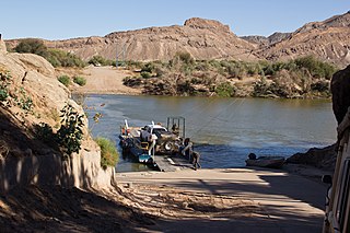
| Description | Crossing the Orange River at Sendelingsdrift |
| Date | |
| Source | NamWCp-228 |
| Author | Gerald de Beer |
| Openstreetmap entry | Link to Openstreetmap |
| Object location | | View this and other nearby images on: OpenStreetMap |
|---|
Licensing
edit
This file is licensed under the Creative Commons Attribution 2.0 Generic license.
- You are free:
- to share – to copy, distribute and transmit the work
- to remix – to adapt the work
- Under the following conditions:
- attribution – You must give appropriate credit, provide a link to the license, and indicate if changes were made. You may do so in any reasonable manner, but not in any way that suggests the licensor endorses you or your use.
| This image was originally posted to Flickr by Gerald dB at https://flickr.com/photos/64495846@N07/7603942550. It was reviewed on 15 July 2017 by FlickreviewR and was confirmed to be licensed under the terms of the cc-by-2.0. |
File history
Click on a date/time to view the file as it appeared at that time.
| Date/Time | Thumbnail | Dimensions | User | Comment | |
|---|---|---|---|---|---|
| current | 17:27, 15 July 2017 | | 5,184 × 3,456 (2.69 MB) | Timk70 (talk | contribs) | =={{int:filedesc}}== {{Information |Description=Crossing the Orange River at Sendelingsdrift |Source=[https://www.flickr.com/photos/gerald_db/7603942550/ NamWCp-228] |Date=2012-06-11 11:01 |Author=[https://www.flickr.com/people/64495846@N07 Gerald de B... |
You cannot overwrite this file.
File usage on Commons
The following 2 pages use this file:
File usage on other wikis
The following other wikis use this file:
- Usage on af.wikipedia.org
- Usage on af.wiktionary.org
- Usage on de.wikipedia.org
- Usage on en.wikipedia.org
- Usage on www.wikidata.org