File:Separated Shared Path near St Peters Interchange.jpg

Size of this preview: 800 × 533 pixels. Other resolutions: 320 × 213 pixels | 640 × 427 pixels | 1,024 × 683 pixels | 1,280 × 853 pixels | 2,560 × 1,707 pixels | 5,620 × 3,747 pixels.
Original file (5,620 × 3,747 pixels, file size: 13.24 MB, MIME type: image/jpeg)
Captions
Captions
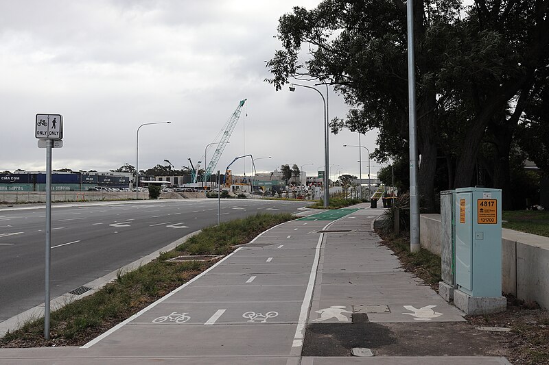
Separated Shared Path near St Peters Interchange in Sydney, Australia. The path is 4.5 metres in width, with 2.5 metres for bicycles and 2 metres for pedestrians.
Summary edit
| Description |
English: Separated Shared Path near St Peters Interchange in Sydney, Australia. The path is 4.5 metres in width, with 2.5 metres for bicycles and 2 metres for pedestrians. The part was constructed as part of the WestConnex project and in this section, the bicycle and pedestrian facilities are directly adjacent, separated by a painted white line |
| Date | |
| Source | Own work |
| Author | Luke Stewart |
| Camera location | | View this and other nearby images on: OpenStreetMap |
|---|
Licensing edit
I, the copyright holder of this work, hereby publish it under the following license:
This file is licensed under the Creative Commons Attribution 4.0 International license.
- You are free:
- to share – to copy, distribute and transmit the work
- to remix – to adapt the work
- Under the following conditions:
- attribution – You must give appropriate credit, provide a link to the license, and indicate if changes were made. You may do so in any reasonable manner, but not in any way that suggests the licensor endorses you or your use.
File history
Click on a date/time to view the file as it appeared at that time.
| Date/Time | Thumbnail | Dimensions | User | Comment | |
|---|---|---|---|---|---|
| current | 15:00, 30 January 2021 | | 5,620 × 3,747 (13.24 MB) | Stewartluke21 (talk | contribs) | Uploaded own work with UploadWizard |
You cannot overwrite this file.
File usage on Commons
The following page uses this file:
File usage on other wikis
The following other wikis use this file:
- Usage on www.wikidata.org