File:Sete Thau vueStClair 24082007.JPG
Size of this preview: 800 × 600 pixels. Other resolutions: 320 × 240 pixels | 640 × 480 pixels | 1,024 × 768 pixels | 1,280 × 960 pixels | 2,048 × 1,536 pixels.
Original file (2,048 × 1,536 pixels, file size: 618 KB, MIME type: image/jpeg)
Captions
Captions
Add a one-line explanation of what this file represents
Summary
edit
| Description |
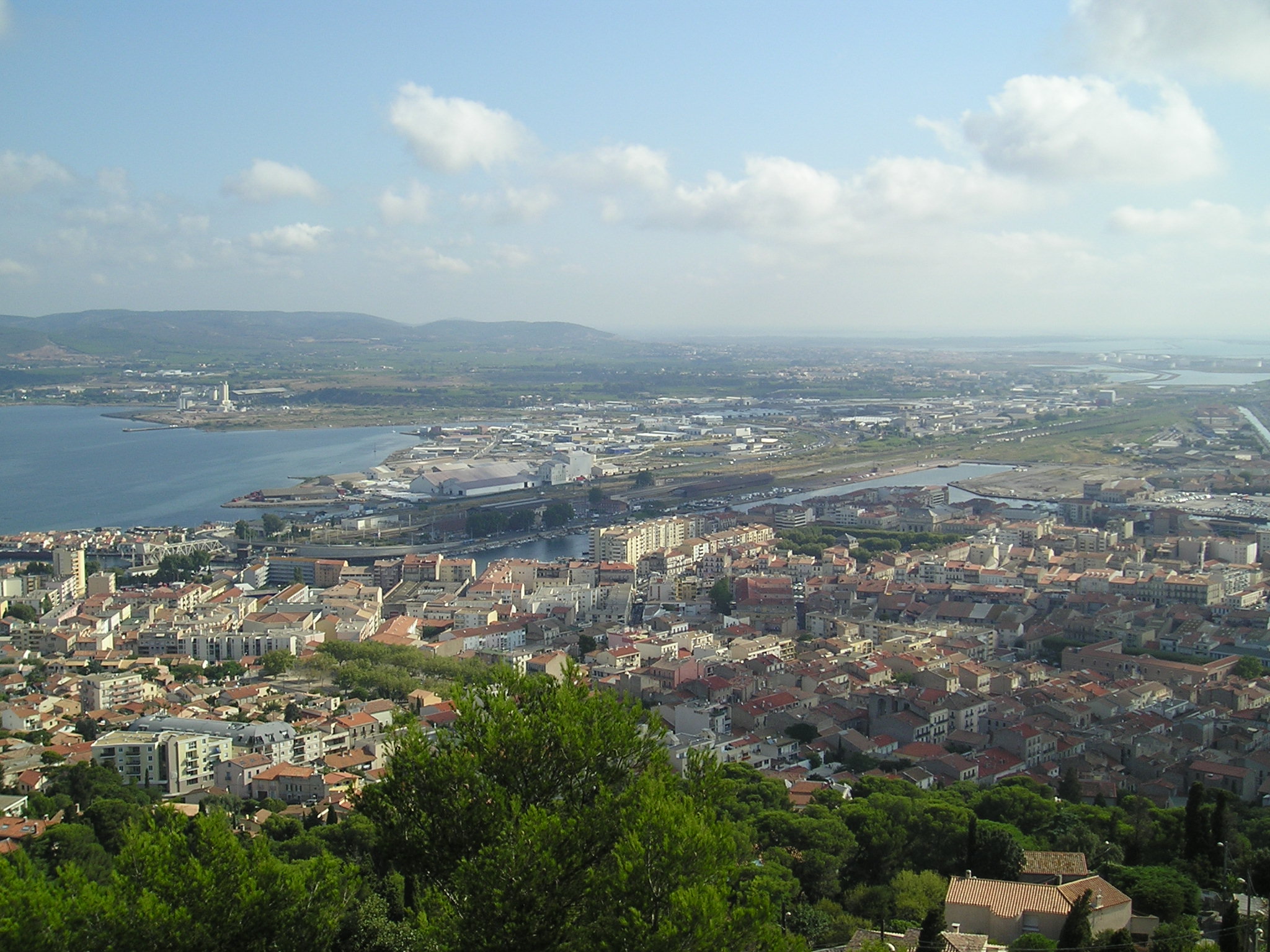
Français : Le bassin de Thau, Sète et Frontignan-La Peyrade, vu depuis le mont Saint-Clair (nord à gauche, sud et mer Méditerranée à droite). L'entrée du canal du Rhône à Sète est visible à partir du centre de la photographie (voir Image:Sete_Thau_vueStClair_24082007_canalRhSte.jpg pour le parcours du canal sur cette photographie). |
| Date | 24 August 2007 / 24 août 2007 |
| Source | Own work |
| Author | Sebjarod |
Licensing
edit
I, the copyright holder of this work, hereby publish it under the following license:
This file is licensed under the Creative Commons Attribution-Share Alike 3.0 Unported license.
- You are free:
- to share – to copy, distribute and transmit the work
- to remix – to adapt the work
- Under the following conditions:
- attribution – You must give appropriate credit, provide a link to the license, and indicate if changes were made. You may do so in any reasonable manner, but not in any way that suggests the licensor endorses you or your use.
- share alike – If you remix, transform, or build upon the material, you must distribute your contributions under the same or compatible license as the original.
File history
Click on a date/time to view the file as it appeared at that time.
| Date/Time | Thumbnail | Dimensions | User | Comment | |
|---|---|---|---|---|---|
| current | 15:34, 21 October 2007 | | 2,048 × 1,536 (618 KB) | Sebjarod (talk | contribs) | == Description == {{Information |Description= {{fr|Le bassin de Thau, Sète et Frontignan-La Peyrade, vu depuis le mont Saint-Clair (nord à gauche, sud et mer Méditerranée à droite). L'entrée du [[:fr:Canal du Rhône à Sète|canal du R |
You cannot overwrite this file.
File usage on Commons
There are no pages that use this file.