File:Sett Valley Trail.svg

Size of this PNG preview of this SVG file: 800 × 441 pixels. Other resolutions: 320 × 176 pixels | 640 × 352 pixels | 1,024 × 564 pixels | 1,280 × 705 pixels | 2,560 × 1,410 pixels | 1,738 × 957 pixels.
Original file (SVG file, nominally 1,738 × 957 pixels, file size: 202 KB)
Captions
Captions
Add a one-line explanation of what this file represents
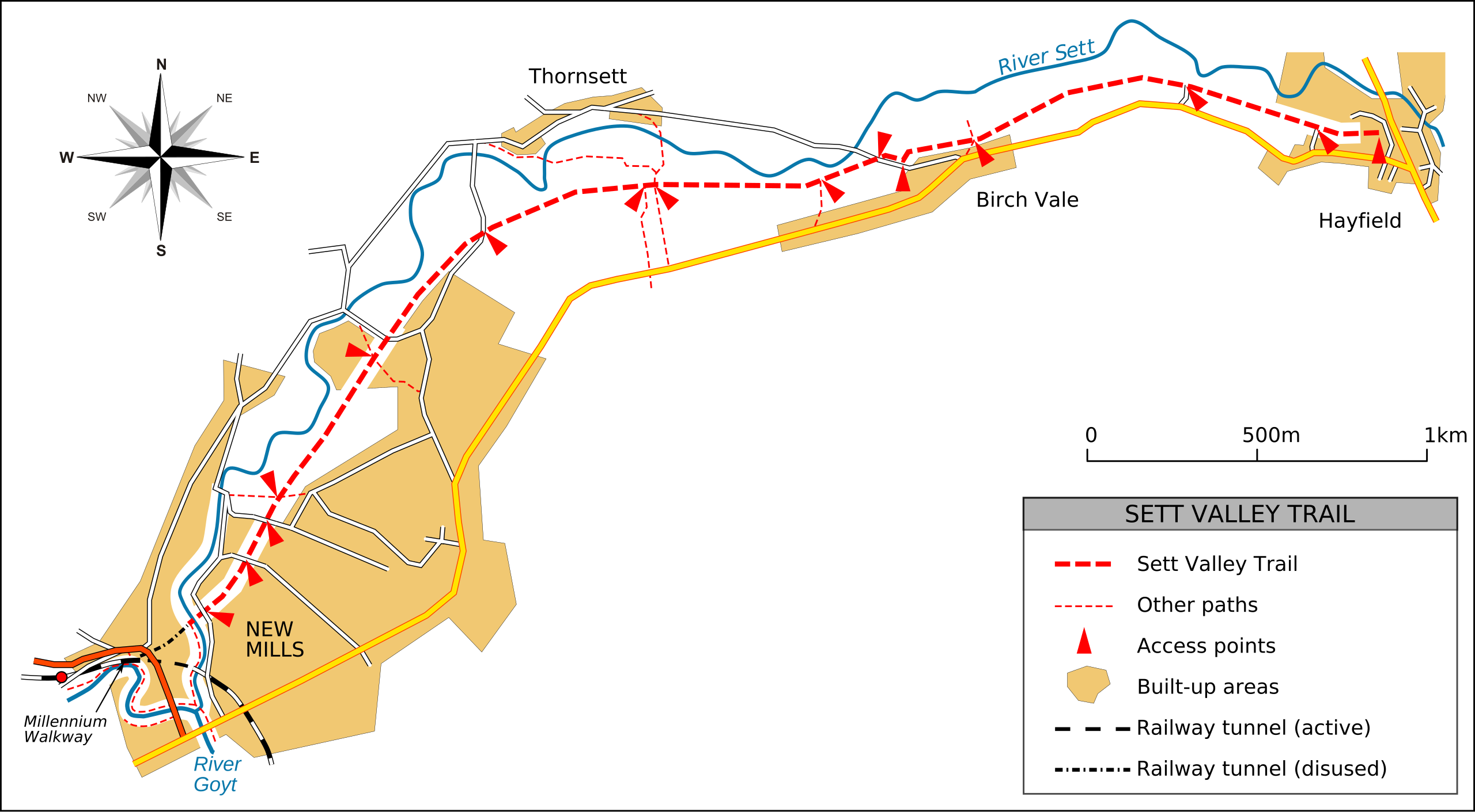
| Description | Sett Valley Trail map | ||
| Date | |||
| Source | Own work | ||
| Author | Dave.Dunford | ||
| Permission (Reusing this file) |
|
File history
Click on a date/time to view the file as it appeared at that time.
| Date/Time | Thumbnail | Dimensions | User | Comment | |
|---|---|---|---|---|---|
| current | 15:48, 9 December 2010 | | 1,738 × 957 (202 KB) | Dave.Dunford (talk | contribs) | fix over/under |
| 15:34, 9 December 2010 |  | 1,738 × 957 (214 KB) | Dave.Dunford (talk | contribs) | objects to path; text along paths; active tunnel on key; additional overbridge | |
| 16:18, 10 July 2010 |  | 1,738 × 957 (107 KB) | Dave.Dunford (talk | contribs) | Border included in drawing | |
| 16:16, 10 July 2010 |  | 1,726 × 939 (107 KB) | Dave.Dunford (talk | contribs) | River label (again) | |
| 16:09, 10 July 2010 |  | 1,726 × 939 (105 KB) | Dave.Dunford (talk | contribs) | River label | |
| 16:08, 10 July 2010 |  | 1,726 × 939 (105 KB) | Dave.Dunford (talk | contribs) | River & road labels, changed licence | |
| 15:46, 10 July 2010 |  | 1,726 × 939 (106 KB) | Dave.Dunford (talk | contribs) | White background | |
| 15:34, 10 July 2010 |  | 1,726 × 939 (106 KB) | Dave.Dunford (talk | contribs) | {{Information |Description=Sett Valley Trail map |Source={{own}} |Date=2010-07-09 |Author=Dave.Dunford |Permission= |other_versions= }} |
You cannot overwrite this file.
File usage on Commons
There are no pages that use this file.
File usage on other wikis
The following other wikis use this file:
- Usage on en.wikipedia.org