File:Settlements allocated land, January-2012.png
Original file (2,629 × 6,738 pixels, file size: 318 KB, MIME type: image/png)
Captions
Captions
Summary
edit
| Description |
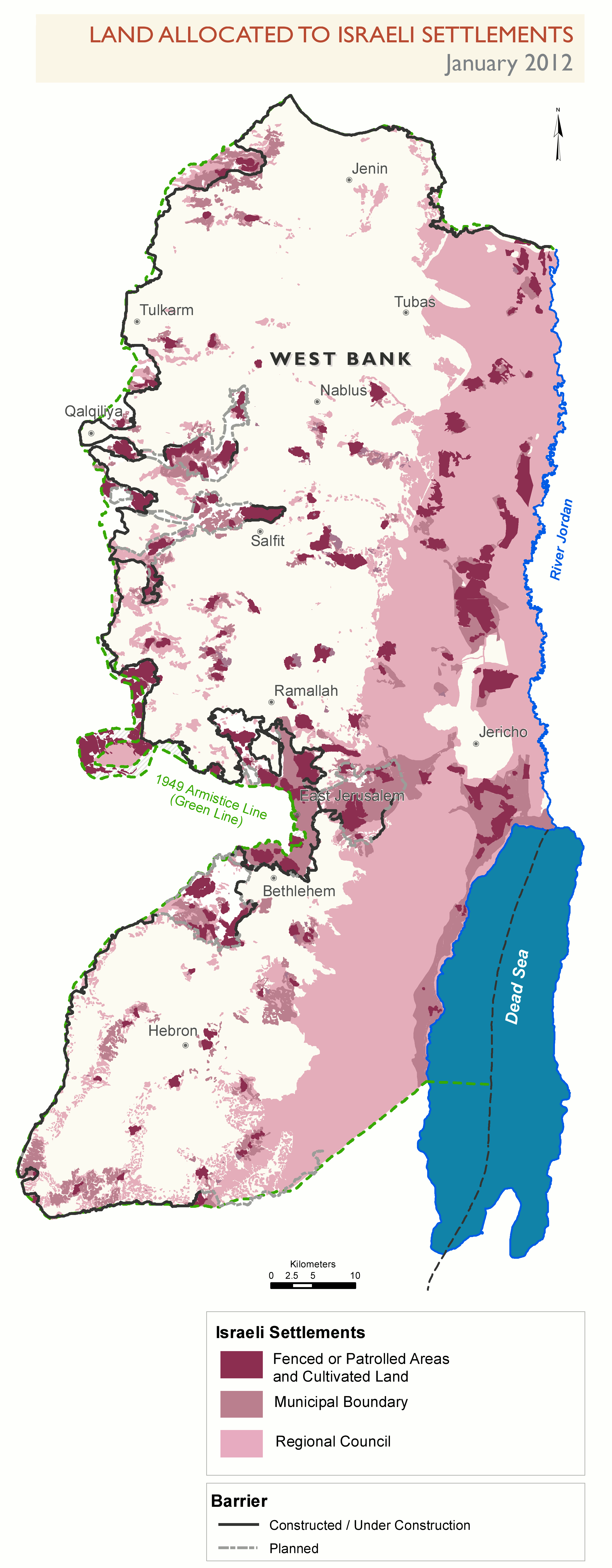
English: Parts of Area C of the West Bank allocated to the Israeli settlements, as of January 2012. No access for Palestinians, in principle. |
| Date | |
| Source | Own work. Adaptation of http://www.ochaopt.org/documents/ocha_opt_land_allocated_for_settlements_January_2012_english.pdf on OCHAoPt Map Centre. |
| Author | Wickey-nl |
Licensing
edit
| This image is a map derived from a United Nations map.
Unless stated otherwise, UN maps are to be considered in the public domain. This applies worldwide. UN maps are, in principle, open source material and you can use them in your work or for making your own map. UN requests however that you delete the UN name, logo and reference number upon any modification to the map. Content of your map will be your responsibility. You can state in your publication, if you wish, something like: based on UN map … (map name, map number, revision number and date). See: Geospatial Information Section. And: Geospatial, location data for a better world. |
 |
File history
Click on a date/time to view the file as it appeared at that time.
| Date/Time | Thumbnail | Dimensions | User | Comment | |
|---|---|---|---|---|---|
| current | 17:00, 14 November 2013 | 2,629 × 6,738 (318 KB) | Wickey-nl (talk | contribs) | User created page with UploadWizard |
You cannot overwrite this file.
File usage on Commons
There are no pages that use this file.
File usage on other wikis
The following other wikis use this file:
- Usage on ca.wikipedia.org
- Usage on en.wikipedia.org
- Usage on fr.wikipedia.org
- Usage on it.wikipedia.org
- Usage on zh.wikipedia.org