File:Sgùrr na Ruaidhe - geograph.org.uk - 1128745.jpg
No higher resolution available.
Sgùrr_na_Ruaidhe_-_geograph.org.uk_-_1128745.jpg (640 × 425 pixels, file size: 48 KB, MIME type: image/jpeg)
Captions
Captions
Add a one-line explanation of what this file represents
Summary
edit
| Description |
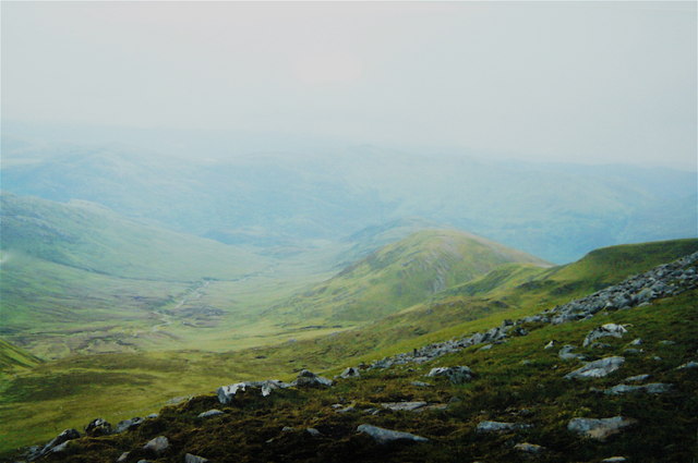
English: Sgùrr na Ruaidhe This view SE from Sgùrr na Ruaidhe shown the sharp change in slope as the gently sloping summit area suddenly falls away. The burn below makes its way through the flat bottomed section of Corry Deanie before it too drops steeply down to the floor of the glen. Much of Strathfarrar is lost in driving rain. If I hadn't needed to be there, I wouldn't have been! |
| Date | |
| Source | From geograph.org.uk |
| Author | AlastairG |
| Attribution (required by the license) | AlastairG / Sgùrr na Ruaidhe / |
| Camera location | | View this and other nearby images on: OpenStreetMap |
|---|
_heading:157.00&language=en)
| Object location | | View this and other nearby images on: OpenStreetMap |
|---|
_heading:157.00&language=en)
Licensing
edit

|
This image was taken from the Geograph project collection. See this photograph's page on the Geograph website for the photographer's contact details. The copyright on this image is owned by AlastairG and is licensed for reuse under the Creative Commons Attribution-ShareAlike 2.0 license.
|
This file is licensed under the Creative Commons Attribution-Share Alike 2.0 Generic license.
Attribution: AlastairG
- You are free:
- to share – to copy, distribute and transmit the work
- to remix – to adapt the work
- Under the following conditions:
- attribution – You must give appropriate credit, provide a link to the license, and indicate if changes were made. You may do so in any reasonable manner, but not in any way that suggests the licensor endorses you or your use.
- share alike – If you remix, transform, or build upon the material, you must distribute your contributions under the same or compatible license as the original.
File history
Click on a date/time to view the file as it appeared at that time.
| Date/Time | Thumbnail | Dimensions | User | Comment | |
|---|---|---|---|---|---|
| current | 01:29, 25 February 2011 | | 640 × 425 (48 KB) | GeographBot (talk | contribs) | == {{int:filedesc}} == {{Information |description={{en|1=Sgùrr na Ruaidhe This view SE from Sgùrr na Ruaidhe shown the sharp change in slope as the gently sloping summit area suddenly falls away. The burn below makes its way through the flat bottomed s |
You cannot overwrite this file.
File usage on Commons
There are no pages that use this file.