File:Shark River Slough.jpg
Size of this preview: 800 × 566 pixels. Other resolutions: 320 × 227 pixels | 640 × 453 pixels | 1,000 × 708 pixels.
Original file (1,000 × 708 pixels, file size: 101 KB, MIME type: image/jpeg)
Captions
Captions
Add a one-line explanation of what this file represents
Summary
edit
| Description |
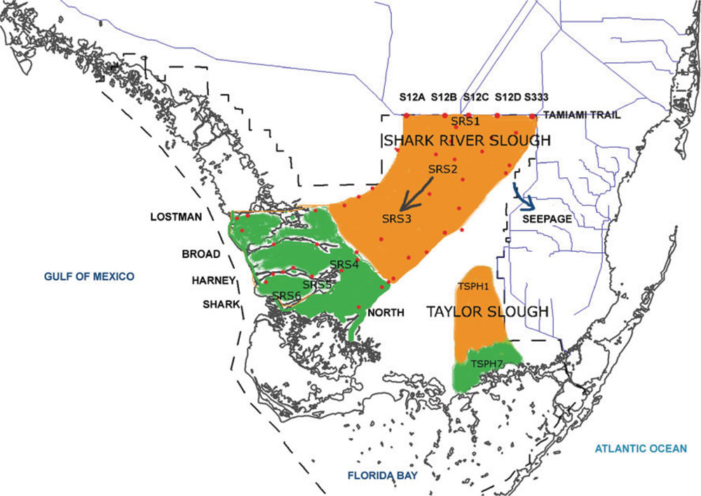
English: Shark River Slough delineated in the Everglades National Park with locations of inflow structures (s12s and s333), major outflowing rivers, and FCE-LTER stations (SRS 1-6). |
| Date | |
| Source | https://sofia.usgs.gov/publications/papers/hydro_budget/intro.html |
| Author | U.S. Department of the Interior, U.S. Geological Survey |
Licensing
edit
This image is in the public domain in the United States because it only contains materials that originally came from the United States Geological Survey, an agency of the United States Department of the Interior. For more information, see the official USGS copyright policy.
|
File history
Click on a date/time to view the file as it appeared at that time.
| Date/Time | Thumbnail | Dimensions | User | Comment | |
|---|---|---|---|---|---|
| current | 17:51, 14 December 2016 | | 1,000 × 708 (101 KB) | Afternoon dew (talk | contribs) | User created page with UploadWizard |
You cannot overwrite this file.
File usage on Commons
There are no pages that use this file.
File usage on other wikis
The following other wikis use this file:
- Usage on en.wikipedia.org