File:Shaw's Mill, Diggle - geograph.org.uk - 1710669.jpg
Shaw's_Mill,_Diggle_-_geograph.org.uk_-_1710669.jpg (640 × 419 pixels, file size: 60 KB, MIME type: image/jpeg)
Captions
Captions
Summary edit
| DescriptionShaw's Mill, Diggle - geograph.org.uk - 1710669.jpg |
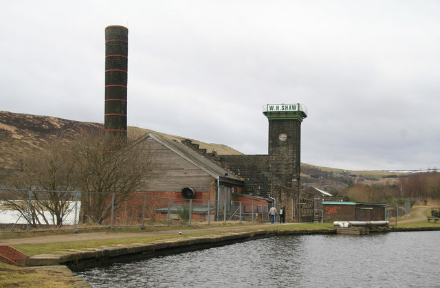
English: Shaw's Mill, Diggle Alongside the Huddersfield Narrow Canal.
Fellow Geograph Member Chris Hodrien has added the following: - This mill and canal (from the opposite angle, looking South-West from the railway footbridge at SE 003073) is a very popular and photogenic background, frequently featuring in steam railway magazines photographing main-line steam train specials attacking the famous stiff climb up past Diggle to Standedge tunnel, the bridge frequently housing up to 30 'gricer' photographers! Incidentally the thin white diagonal bridge shown on the OS map section crossing the canal just North of the mill does not exist, with no indication that it ever has. On the North side of the yellow lane, just east of the railway overbridge, opposite the little residential side road at SE003075, just down the grassy slope by the start of the footpath, can be found a rare in-situ LNWR cast iron boundary marker. The wide section of canal in the foreground will have been a boat 'winding (turning) hole', just below the nicely-restored lock. The stone tower on the Mill supports a cast iron water tank which was used for fire-fighting (sprinkler mains) and process water. Can any reader add more detail on the original and present activities at the mill? |
| Date | |
| Source | From geograph.org.uk |
| Author | Chris Allen |
| Attribution (required by the license) InfoField | Chris Allen / Shaw's Mill, Diggle / |
InfoField | Chris Allen / Shaw's Mill, Diggle |
| Camera location | 53° 33′ 39″ N, 1° 59′ 55″ W | View this and other nearby images on: OpenStreetMap |
|---|
| Object location | 53° 33′ 41″ N, 1° 59′ 55″ W | View this and other nearby images on: OpenStreetMap |
|---|
Licensing edit

|
This image was taken from the Geograph project collection. See this photograph's page on the Geograph website for the photographer's contact details. The copyright on this image is owned by Chris Allen and is licensed for reuse under the Creative Commons Attribution-ShareAlike 2.0 license.
|
- You are free:
- to share – to copy, distribute and transmit the work
- to remix – to adapt the work
- Under the following conditions:
- attribution – You must give appropriate credit, provide a link to the license, and indicate if changes were made. You may do so in any reasonable manner, but not in any way that suggests the licensor endorses you or your use.
- share alike – If you remix, transform, or build upon the material, you must distribute your contributions under the same or compatible license as the original.
File history
Click on a date/time to view the file as it appeared at that time.
| Date/Time | Thumbnail | Dimensions | User | Comment | |
|---|---|---|---|---|---|
| current | 09:17, 5 March 2011 |  | 640 × 419 (60 KB) | GeographBot (talk | contribs) | == {{int:filedesc}} == {{Information |description={{en|1=Shaw's Mill, Diggle Alongside the Huddersfield Narrow Canal. Fellow Geograph Member Chris Hodrien has added the following: - This mill and canal (from the opposite angle, looking South-West fr |
You cannot overwrite this file.
File usage on Commons
There are no pages that use this file.
Metadata
This file contains additional information such as Exif metadata which may have been added by the digital camera, scanner, or software program used to create or digitize it. If the file has been modified from its original state, some details such as the timestamp may not fully reflect those of the original file. The timestamp is only as accurate as the clock in the camera, and it may be completely wrong.
| _error | 0 |
|---|
