File:Shiloh battlefield topical map.png
Size of this preview: 722 × 599 pixels. Other resolutions: 289 × 240 pixels | 578 × 480 pixels | 989 × 821 pixels.
Original file (989 × 821 pixels, file size: 1.76 MB, MIME type: image/png)
Captions
Captions
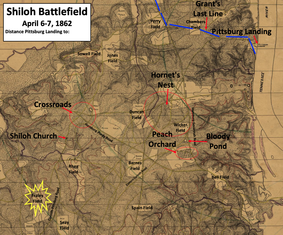
Fighting started in Fraley Field, and Grant's army was pushed back to Pittsburg Landing
Summary
edit
| Description |
English: This is an image from a Shiloh National Military Park map, and TwoScarsUp has added more labels to make it easier to read. The map shows places of importance, including field names, on the Shiloh battlefield. The battle took place on April 6 & 7, 1862. The locations of the Crossroads, Peach Orchard, Hornet's Nest, and Grant's Last Line are based on maps in "Shiloh and the Western Campaign of 1862" by O. Edward Cunningham, including the maps on pages 220, 239, 267, and 328. The location of the Bloody Pond is shown on a map on page 14 of Jeff Shaara's "Civil War Battlefields". |
| Date | |
| Source | This a modified and cropped file called "Map of the Battlefield of Shiloh", which can be found in the Library of Congress here. |
| Author | The file, created in 1920, is from the Shiloh National Military Park. Additional labels added by TwoScarsUp. |
Southern Tennessee, USA.
Licensing
edit
This work is in the public domain in the United States because it was published (or registered with the U.S. Copyright Office) before January 1, 1929.
Public domain works must be out of copyright in both the United States and in the source country of the work in order to be hosted on the Commons. If the work is not a U.S. work, the file must have an additional copyright tag indicating the copyright status in the source country.
Note: This tag should not be used for sound recordings. |
File history
Click on a date/time to view the file as it appeared at that time.
| Date/Time | Thumbnail | Dimensions | User | Comment | |
|---|---|---|---|---|---|
| current | 18:40, 22 July 2022 | | 989 × 821 (1.76 MB) | TwoScarsUp (talk | contribs) | Uploaded a work by The file, created in 1920, is from the Shiloh National Military Park. Additional labels added by TwoScarsUp. from This a modified and cropped file called "Map of the Battlefield of Shiloh", which can be found in the Library of Congress [https://www.loc.gov/item/99448457/ here]. with UploadWizard |
You cannot overwrite this file.
File usage on Commons
The following page uses this file: