File:Shotley Marina approach channel - geograph.org.uk - 1543323.jpg
No higher resolution available.
Shotley_Marina_approach_channel_-_geograph.org.uk_-_1543323.jpg (640 × 427 pixels, file size: 58 KB, MIME type: image/jpeg)
Captions
Captions
Add a one-line explanation of what this file represents
Summary
edit
| Description |
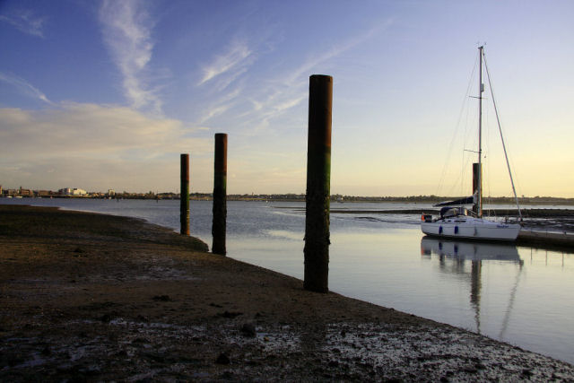
English: Shotley Marina approach channel Seen here at low water, the mud and shingle banks can be seen on either side of the dredged channel in the approach to Shotley Marina, at the confluence of the Stour and Orwell rivers. A yacht waits on the landing stage for the tide to turn, to be able to enter the lock. The three posts, which are high enough to remain exposed at high water, indicate the eastern edge of the channel. |
| Date | |
| Source | From geograph.org.uk |
| Author | Bob Jones |
| Attribution (required by the license) | Bob Jones / Shotley Marina approach channel / |
| Camera location | | View this and other nearby images on: OpenStreetMap |
|---|
_heading:157.00&language=en)
| Object location | | View this and other nearby images on: OpenStreetMap |
|---|
_heading:157.00&language=en)
Licensing
edit

|
This image was taken from the Geograph project collection. See this photograph's page on the Geograph website for the photographer's contact details. The copyright on this image is owned by Bob Jones and is licensed for reuse under the Creative Commons Attribution-ShareAlike 2.0 license.
|
This file is licensed under the Creative Commons Attribution-Share Alike 2.0 Generic license.
Attribution: Bob Jones
- You are free:
- to share – to copy, distribute and transmit the work
- to remix – to adapt the work
- Under the following conditions:
- attribution – You must give appropriate credit, provide a link to the license, and indicate if changes were made. You may do so in any reasonable manner, but not in any way that suggests the licensor endorses you or your use.
- share alike – If you remix, transform, or build upon the material, you must distribute your contributions under the same or compatible license as the original.
File history
Click on a date/time to view the file as it appeared at that time.
| Date/Time | Thumbnail | Dimensions | User | Comment | |
|---|---|---|---|---|---|
| current | 10:48, 3 March 2011 | | 640 × 427 (58 KB) | GeographBot (talk | contribs) | == {{int:filedesc}} == {{Information |description={{en|1=Shotley Marina approach channel Seen here at low water, the mud and shingle banks can be seen on either side of the dredged channel in the approach to Shotley Marina, at the confluence of the Stour |
You cannot overwrite this file.
File usage on Commons
There are no pages that use this file.