File:Shubert map 3v - R14L16v2 - Tula.jpg

Original file (4,571 × 3,476 pixels, file size: 5.74 MB, MIME type: image/jpeg)
Captions
Captions
Summary
edit
| Description |
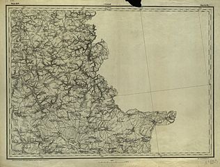
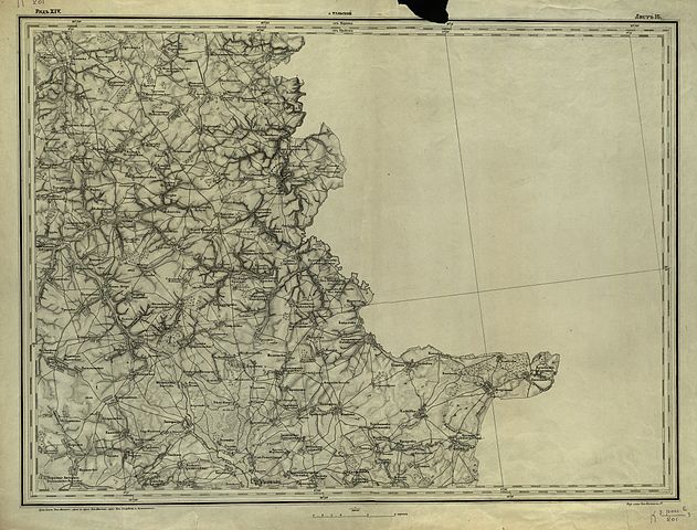
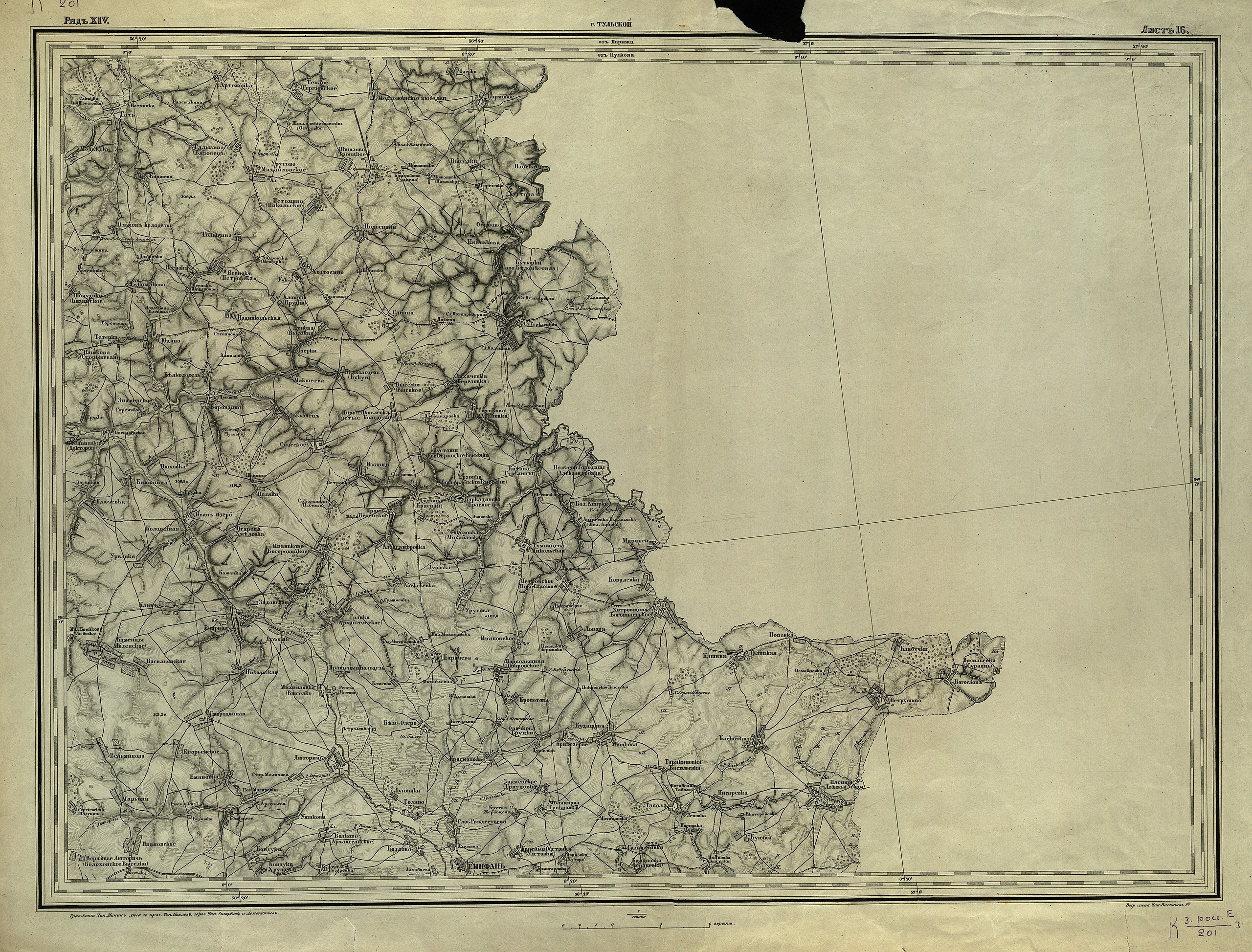
English: "Shubert map". Fragment of topographic map of Tula Governorate. Printed in 1850. 3 versta in inch (1260 m in 1 cm).
Русский: Карта Шуберта. Лист из комплекта топографических карт Тульской губернии.1850 гг. Масштаб: 3 версты в дюйме. (1 см-840м) .(1:126000)
This file was uploaded with Commonist. |
| Date | |
| Source | http://apamh.com/index.php/joomla/template-articles |
| Author |
Русский: Фёдор Фёдорович Шуберт (1789-1865), гравёры Военно-топографического депо, "вольные" гравёры |
Licensing
edit
|
This work is in the public domain in its country of origin and other countries and areas where the copyright term is the author's life plus 70 years or fewer.
| |
| This file has been identified as being free of known restrictions under copyright law, including all related and neighboring rights. | |
File history
Click on a date/time to view the file as it appeared at that time.
| Date/Time | Thumbnail | Dimensions | User | Comment | |
|---|---|---|---|---|---|
| current | 10:13, 29 January 2013 | | 4,571 × 3,476 (5.74 MB) | Slick-o-bot (talk | contribs) | Bot: convert to a non-interlaced jpeg (see bug #17645) |
| 10:31, 27 November 2011 |  | 4,571 × 3,476 (5.42 MB) | ShinePhantom (talk | contribs) |
You cannot overwrite this file.
File usage on Commons
There are no pages that use this file.