File:Sibratsgfaell-chapel-former chapel-02ESD.jpg

Size of this preview: 800 × 432 pixels. Other resolutions: 320 × 173 pixels | 640 × 346 pixels | 1,024 × 554 pixels | 1,280 × 692 pixels | 2,560 × 1,384 pixels | 4,586 × 2,479 pixels.
Original file (4,586 × 2,479 pixels, file size: 980 KB, MIME type: image/jpeg)
Captions
Captions
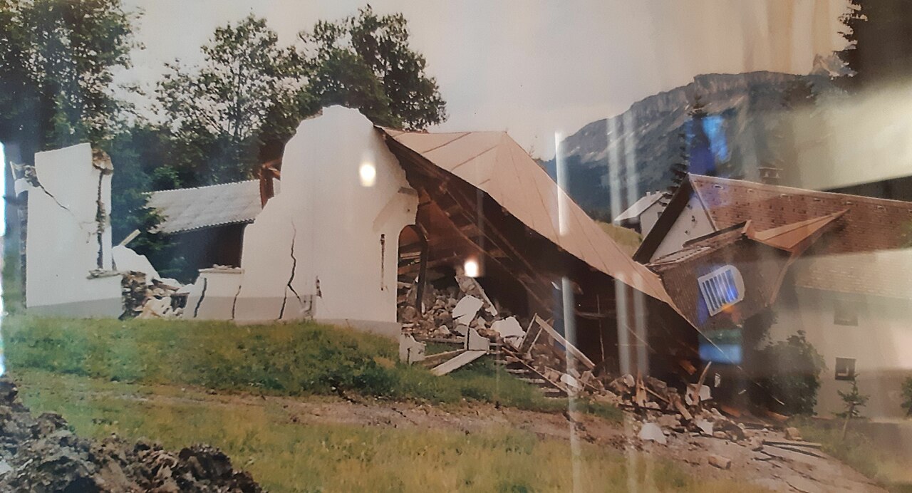
Former Saint Mary of Help in the district of Rindberg in the municipality of Sibratsgfaelle in Vorarlberg, Austria
Summary edit
| Description |
Deutsch: Abgegangene Maria-Hilf-Kapelle im Ortsteil Rindberg in der Gemeinde Sibratsgfäll in Vorarlberg, Österreich. 1999 durch eine Hangrutschung zerstört.
English: Former Chapel St. Mary of Help in the district of Rindberg in the municipality of Sibratsgälle in Vorarlberg, Austria. Destroyed by landslide in 1999.
Français : Ancienne chapelle Sainte Marie Auxiliatrice dans le district de Rindberg dans la municipalité de Sibratsgälle dans le Vorarlberg, en Autriche. Détruit par un glissement de terrain en 1999. |
| Date | |
| Source | Own work |
| Author | Rikki Mitterer |
| Camera location | | View this and other nearby images on: OpenStreetMap |
|---|
Licensing edit
I, the copyright holder of this work, hereby publish it under the following license:
This file is licensed under the Creative Commons Attribution-Share Alike 4.0 International license.
- You are free:
- to share – to copy, distribute and transmit the work
- to remix – to adapt the work
- Under the following conditions:
- attribution – You must give appropriate credit, provide a link to the license, and indicate if changes were made. You may do so in any reasonable manner, but not in any way that suggests the licensor endorses you or your use.
- share alike – If you remix, transform, or build upon the material, you must distribute your contributions under the same or compatible license as the original.
File history
Click on a date/time to view the file as it appeared at that time.
| Date/Time | Thumbnail | Dimensions | User | Comment | |
|---|---|---|---|---|---|
| current | 17:29, 20 December 2020 | | 4,586 × 2,479 (980 KB) | Rikki Mitterer (talk | contribs) | Uploaded own work with UploadWizard |
You cannot overwrite this file.
File usage on Commons
The following 2 pages use this file: