File:Siechnice (gmina) location map.png

Original file (1,073 × 776 pixels, file size: 377 KB, MIME type: image/png)
Captions
Captions
Summary
edit_location_map.png&action=edit§ion=1)
| Description |
English: Location map |
| Date | |
| Source | Own work |
| Author | Smat |
| Description |
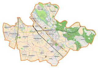
Polski: Mapa gminy Siechnice, Polska
English: Map of Siechnice (gmina), Poland |
|||||||||
| Date | ||||||||||
| Source | You may find a page on the OpenStreetMap wiki page for Siechnice (gmina) | |||||||||
| Creator |
OpenStreetMap contributors OpenStreetMap contributors |
|||||||||
| Permission (Reusing this file) |
OpenStreetMap data is available under the Open Database License (details). Map tiles are licensed under the Creative Commons Attribution-ShareAlike 2.0 license (CC-BY-SA 2.0).
This file is licensed under the Creative Commons Attribution-Share Alike 2.0 Generic license.
|
|||||||||
| Geotemporal data | ||||||||||
| Bounding box |
|
|||||||||
| Georeferencing | If inappropriate please set warp_status = skip to hide. | |||||||||
Licensing
edit_location_map.png&action=edit§ion=2)
| This work contains information from OpenStreetMap, which is made available under the Open Database License (ODbL).
The ODbL does not require any particular license for maps produced from ODbL data. Prior to 1 August 2020, map tiles produced by the OpenStreetMap Foundation were licensed under the CC-BY-SA-2.0 license. Maps produced by other people may be subject to other licences. |
File history
Click on a date/time to view the file as it appeared at that time.
| Date/Time | Thumbnail | Dimensions | User | Comment | |
|---|---|---|---|---|---|
| current | 17:07, 14 February 2017 | | 1,073 × 776 (377 KB) | Smat (talk | contribs) | User created page with UploadWizard |
You cannot overwrite this file.
File usage on Commons
There are no pages that use this file.
File usage on other wikis
The following other wikis use this file:
- Usage on pl.wikipedia.org
- Siechnice
- Święta Katarzyna (województwo dolnośląskie)
- Sulęcin (województwo dolnośląskie)
- Radwanice (powiat wrocławski)
- Biestrzyków
- Groblice
- Grodziszów
- Łukaszowice
- Ozorzyce
- Trestno
- Żerniki Wrocławskie
- Zacharzyce
- Zębice
- Mokry Dwór (województwo dolnośląskie)
- Sulimów (województwo dolnośląskie)
- Bogusławice (powiat wrocławski)
- Iwiny (powiat wrocławski)
- Kotowice (powiat wrocławski)
- Smardzów (powiat wrocławski)
- Blizanowice
- Durok
- Szostakowice
- Radomierzyce (powiat wrocławski)
- Zakrzów Kotowice
- Jezioro Panieńskie (dolnośląskie)
- Siechnice (stacja kolejowa)
- Elektrociepłownia Czechnica
- Święta Katarzyna (stacja kolejowa)
- Jezioro Dziewicze (dolnośląskie)
- Siechnice (gmina)
- Zębice Wrocławskie
- Parafia Najświętszego Serca Pana Jezusa w Żernikach Wrocławskich
- Parafia Niepokalanego Serca Najświętszej Maryi Panny w Siechnicach
- Smardzów Wrocławski
- Kościół św. Katarzyny Aleksandryjskiej w Świętej Katarzynie
- Parafia Najświętszej Maryi Panny Różańcowej w Radwanicach
- Parafia św. Katarzyny Aleksandryjskiej w Świętej Katarzynie
- Parafia Najświętszego Serca Pana Jezusa w Kotowicach
- Moduł:Mapa/dane/Siechnice
- Kościół Niepokalanego Serca Najświętszej Maryi Panny w Siechnicach
- Moduł:Mapa/dane/Siechnice (gmina)
- Iwiny (przystanek kolejowy)
- Wydmy w gminie Siechnice
- Kościół Niepokalanego Poczęcia Najświętszej Maryi Panny w Trestnie
- Prawocin
- Usage on pl.wikibooks.org
_location_map.png&oldid=607600988)