File:Silt on Redclyffe Bridge.jpg

Size of this preview: 800 × 600 pixels. Other resolutions: 320 × 240 pixels | 640 × 480 pixels | 1,024 × 768 pixels | 1,280 × 960 pixels | 1,600 × 1,200 pixels.
Original file (1,600 × 1,200 pixels, file size: 272 KB, MIME type: image/jpeg)
Captions
Captions
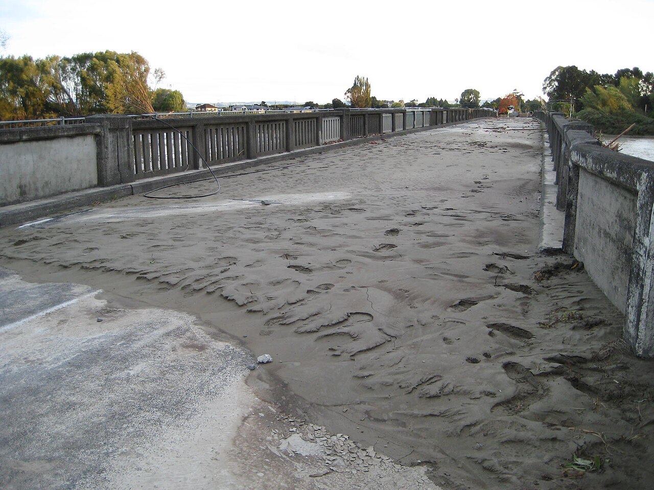
Silt on Redclyffe Bridge after Cyclone Gabrielle
Summary
edit
| Description |
English: Silt on Redclyffe Bridge after Cyclone Gabrielle. View from the Taradale side, with houses at Waiohiki visible on the far side. The bridge is snapped in two nearer the Waiohiki side. Black cable at left is from repairs being done by an electricity company. |
| Date | |
| Source | Own work |
| Author | Nurg |
| Camera location | | View this and other nearby images on: OpenStreetMap |
|---|
Licensing
edit
I, the copyright holder of this work, hereby publish it under the following license:
This file is licensed under the Creative Commons Attribution-Share Alike 4.0 International license.
- You are free:
- to share – to copy, distribute and transmit the work
- to remix – to adapt the work
- Under the following conditions:
- attribution – You must give appropriate credit, provide a link to the license, and indicate if changes were made. You may do so in any reasonable manner, but not in any way that suggests the licensor endorses you or your use.
- share alike – If you remix, transform, or build upon the material, you must distribute your contributions under the same or compatible license as the original.
File history
Click on a date/time to view the file as it appeared at that time.
| Date/Time | Thumbnail | Dimensions | User | Comment | |
|---|---|---|---|---|---|
| current | 03:14, 5 March 2023 | | 1,600 × 1,200 (272 KB) | Nurg (talk | contribs) | Uploaded own work with UploadWizard |
You cannot overwrite this file.
File usage on Commons
There are no pages that use this file.