File:Silueta města Česká Kamenice.jpg

Size of this preview: 800 × 450 pixels. Other resolutions: 320 × 180 pixels | 640 × 360 pixels | 1,024 × 576 pixels | 1,280 × 720 pixels | 2,560 × 1,440 pixels | 4,224 × 2,376 pixels.
Original file (4,224 × 2,376 pixels, file size: 3.3 MB, MIME type: image/jpeg)
Captions
Captions
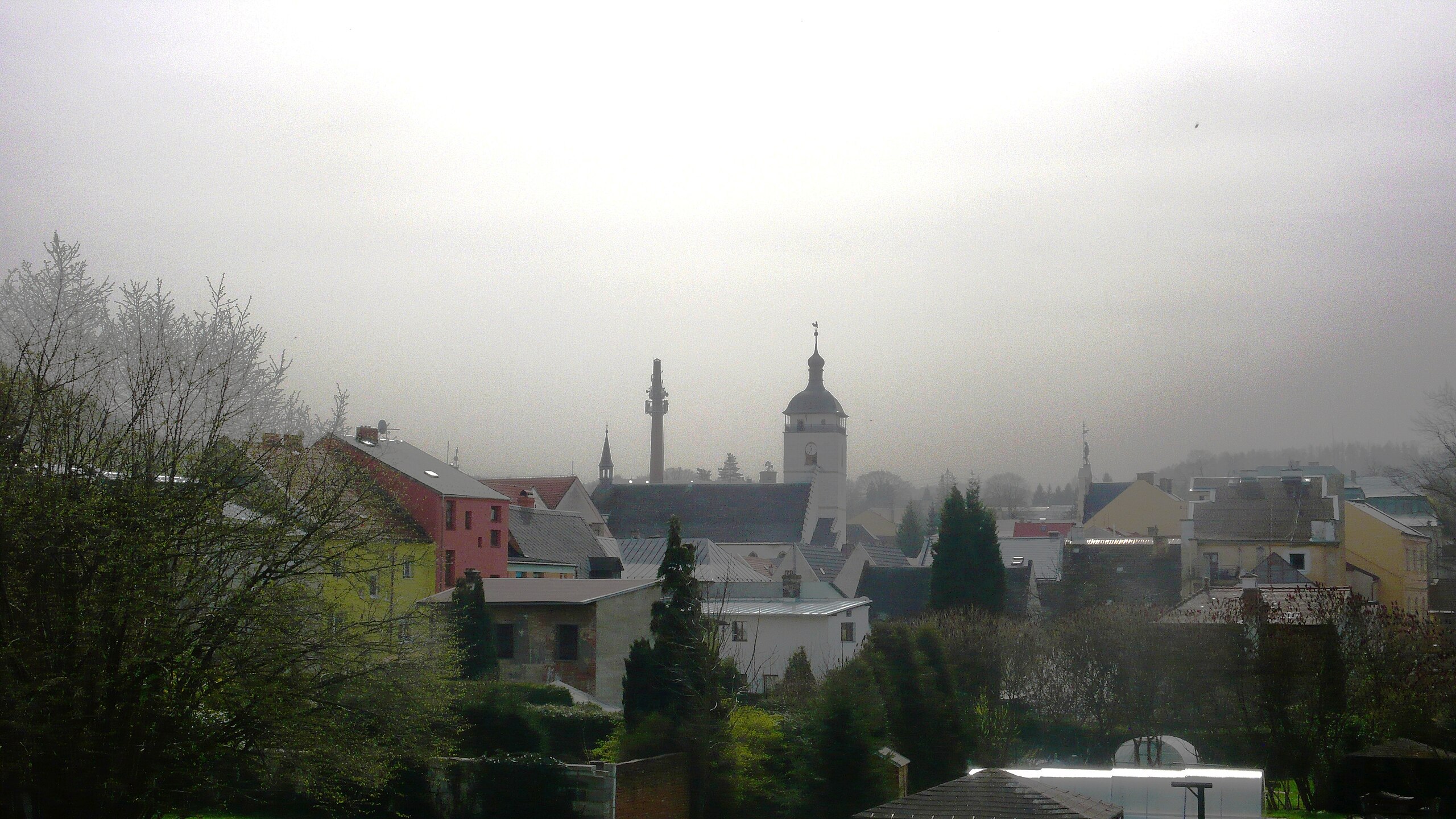
The historical core of Česká Kamenice is a monument reservation.
Summary
edit
| Description |
Čeština: Město nad řekou Kamenicí bylo založeno na konci 13. století. Siluetě historického centra města dominuje věž kostela sv. Jakuba většího postavená v letech 1552-1555.
English: The town above the Kamenice River was founded at the end of the 13th century. The silhouette of the historic city center is dominated by the tower of the church of St. James the Great built in 1552-1555. |
| Date | |
| Source | Own work |
| Author | František Šťastný |
| Camera location | | View this and other nearby images on: OpenStreetMap |
|---|
Licensing
edit
I, the copyright holder of this work, hereby publish it under the following license:
This file is licensed under the Creative Commons Attribution-Share Alike 4.0 International license.
- You are free:
- to share – to copy, distribute and transmit the work
- to remix – to adapt the work
- Under the following conditions:
- attribution – You must give appropriate credit, provide a link to the license, and indicate if changes were made. You may do so in any reasonable manner, but not in any way that suggests the licensor endorses you or your use.
- share alike – If you remix, transform, or build upon the material, you must distribute your contributions under the same or compatible license as the original.
File history
Click on a date/time to view the file as it appeared at that time.
| Date/Time | Thumbnail | Dimensions | User | Comment | |
|---|---|---|---|---|---|
| current | 16:32, 6 May 2024 | | 4,224 × 2,376 (3.3 MB) | František Šťastný (talk | contribs) | Uploaded own work with UploadWizard |
You cannot overwrite this file.
File usage on Commons
There are no pages that use this file.