File:Six-Day War Map he.svg

Size of this PNG preview of this SVG file: 432 × 599 pixels. Other resolutions: 173 × 240 pixels | 346 × 480 pixels | 554 × 768 pixels | 738 × 1,024 pixels | 1,477 × 2,048 pixels | 884 × 1,226 pixels.
Original file (SVG file, nominally 884 × 1,226 pixels, file size: 2.2 MB)
Captions
Captions
Add a one-line explanation of what this file represents
Summary
edit
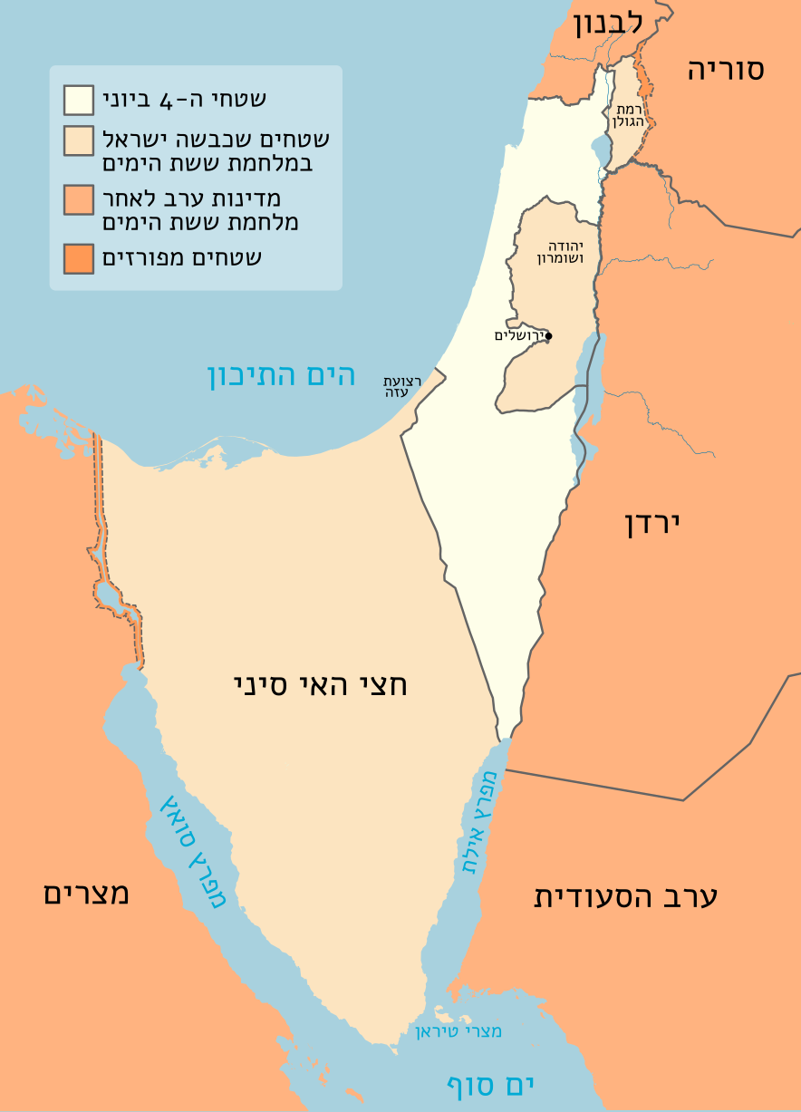
| Description | Map of Israel in the Six-Day War. Derived from Israel_location_map.svg, Dynamap_suez.png and OpenStreetMap. |
| Date | 5.23.20 |
| Source | Own work |
| Author | Matankic |
| SVG development | This W3C-invalid vector image was created with Inkscape. |
Licensing
edit
I, the copyright holder of this work, hereby publish it under the following license:
This file is licensed under the Creative Commons Attribution-Share Alike 4.0 International license.
- You are free:
- to share – to copy, distribute and transmit the work
- to remix – to adapt the work
- Under the following conditions:
- attribution – You must give appropriate credit, provide a link to the license, and indicate if changes were made. You may do so in any reasonable manner, but not in any way that suggests the licensor endorses you or your use.
- share alike – If you remix, transform, or build upon the material, you must distribute your contributions under the same or compatible license as the original.
File history
Click on a date/time to view the file as it appeared at that time.
| Date/Time | Thumbnail | Dimensions | User | Comment | |
|---|---|---|---|---|---|
| current | 15:45, 20 June 2023 | | 884 × 1,226 (2.2 MB) | רונאלדיניו המלך (talk | contribs) | הסרת הריבוע הריק |
| 20:32, 19 June 2023 |  | 884 × 1,226 (2.2 MB) | Geagea (talk | contribs) | per https://he.wikipedia.org/w/index.php?title=ויקיפדיה:סדנה_לגרפיקה&oldid=36526868#תיקון_מפה // Editing SVG source code using c:User:Rillke/SVGedit.js | |
| 23:35, 22 May 2020 |  | 884 × 1,226 (2.21 MB) | Matankic (talk | contribs) | Font. Object->Path | |
| 23:32, 22 May 2020 |  | 884 × 1,226 (2.03 MB) | Matankic (talk | contribs) | {{Information |description=Map of Israel in the Six-Day War. Derived from File:Israel_location_map.svg and w:en:OpenStreetMap |date=5.23.20 |source= |author= |permission= |other versions= }} |
You cannot overwrite this file.
File usage on Commons
The following 2 pages use this file:
File usage on other wikis
The following other wikis use this file: