File:Skön-karta.png

Size of this preview: 516 × 599 pixels. Other resolutions: 207 × 240 pixels | 413 × 480 pixels | 652 × 757 pixels.
Original file (652 × 757 pixels, file size: 306 KB, MIME type: image/png)
Captions
Captions
Add a one-line explanation of what this file represents
Summary
edit
| Description |
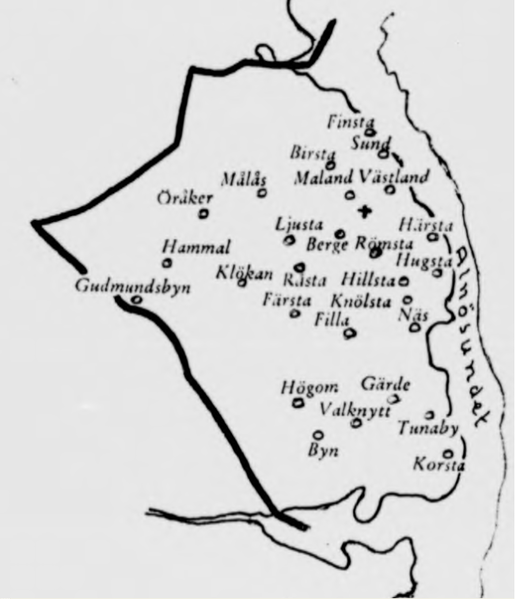
Svenska: Karta över byar i Sköns socken (Y), medeltid fram till 1850-talets industrialisering.
English: Map of villages in Skön parish (Y county) from middle ages until the industrialization in the 1850s |
| Date | |
| Source | Parish register from before 1895. Digitized by Svar/Riksarkivet. |
| Author | Sköns församling |
| Camera location | | View this and other nearby images on: OpenStreetMap |
|---|
Licensing
edit
|
This work is in the public domain in its country of origin and other countries and areas where the copyright term is the author's life plus 70 years or fewer. This work is in the public domain in the United States because it was published (or registered with the U.S. Copyright Office) before January 1, 1929. | |
| This file has been identified as being free of known restrictions under copyright law, including all related and neighboring rights. | |
File history
Click on a date/time to view the file as it appeared at that time.
| Date/Time | Thumbnail | Dimensions | User | Comment | |
|---|---|---|---|---|---|
| current | 20:55, 28 June 2016 | | 652 × 757 (306 KB) | Mange01 (talk | contribs) | Cropping |
| 20:55, 28 June 2016 |  | 652 × 757 (306 KB) | Mange01 (talk | contribs) | Cropping | |
| 20:50, 28 June 2016 |  | 960 × 757 (327 KB) | Mange01 (talk | contribs) | User created page with UploadWizard |
You cannot overwrite this file.
File usage on Commons
There are no pages that use this file.
File usage on other wikis
The following other wikis use this file:
- Usage on sv.wikipedia.org