File:Sketch Map of a part of Southern Palestine, 1886.jpg

Original file (3,455 × 3,185 pixels, file size: 1.45 MB, MIME type: image/jpeg)
Captions
Captions
| Title |
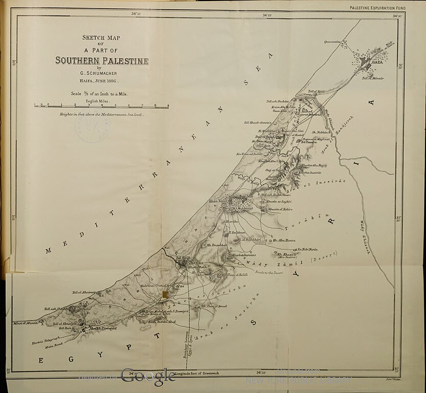
Sketch Map of a part of Southern Palestine [Gaza] |
|||||||||||||||||||||||
| Description |
A map made by Gottlieb Schumacher of the coastal area of Gaza, extending roughly the same as today's Gaza strip, in 1886. |
|||||||||||||||||||||||
| Date | ||||||||||||||||||||||||
| Source | https://hdl.handle.net/2027/nyp.33433061980383?urlappend=%3Bseq=193%3Bownerid=93168056-0 | |||||||||||||||||||||||
| Creator |
|
|||||||||||||||||||||||
| Permission (Reusing this file) |
|
|||||||||||||||||||||||
| Georeferencing | If inappropriate please set warp_status = skip to hide. | |||||||||||||||||||||||
| Bibliographic data | ||||||||||||||||||||||||
| Publication |
Palestine exploration Fund Quarterly Statement |
|||||||||||||||||||||||
| Volume | 18 (4) | |||||||||||||||||||||||
| Publisher |
Palestine exploration Fund |
|||||||||||||||||||||||
| Scan resolution | 300 dpi | |||||||||||||||||||||||

File history
Click on a date/time to view the file as it appeared at that time.
| Date/Time | Thumbnail | Dimensions | User | Comment | |
|---|---|---|---|---|---|
| current | 22:49, 22 May 2022 | | 3,455 × 3,185 (1.45 MB) | Danny lost (talk | contribs) | pattypan 22.03 |
You cannot overwrite this file.
File usage on Commons
There are no pages that use this file.