File:Sketch of part of the London Township.jpg
Size of this preview: 571 × 599 pixels. Other resolutions: 229 × 240 pixels | 457 × 480 pixels | 732 × 768 pixels | 976 × 1,024 pixels | 1,525 × 1,600 pixels.
Original file (1,525 × 1,600 pixels, file size: 562 KB, MIME type: image/jpeg)
Captions
Captions
Sketch of part of the London Township
Summary
edit
| Title |
Sketch of part of the London Township |
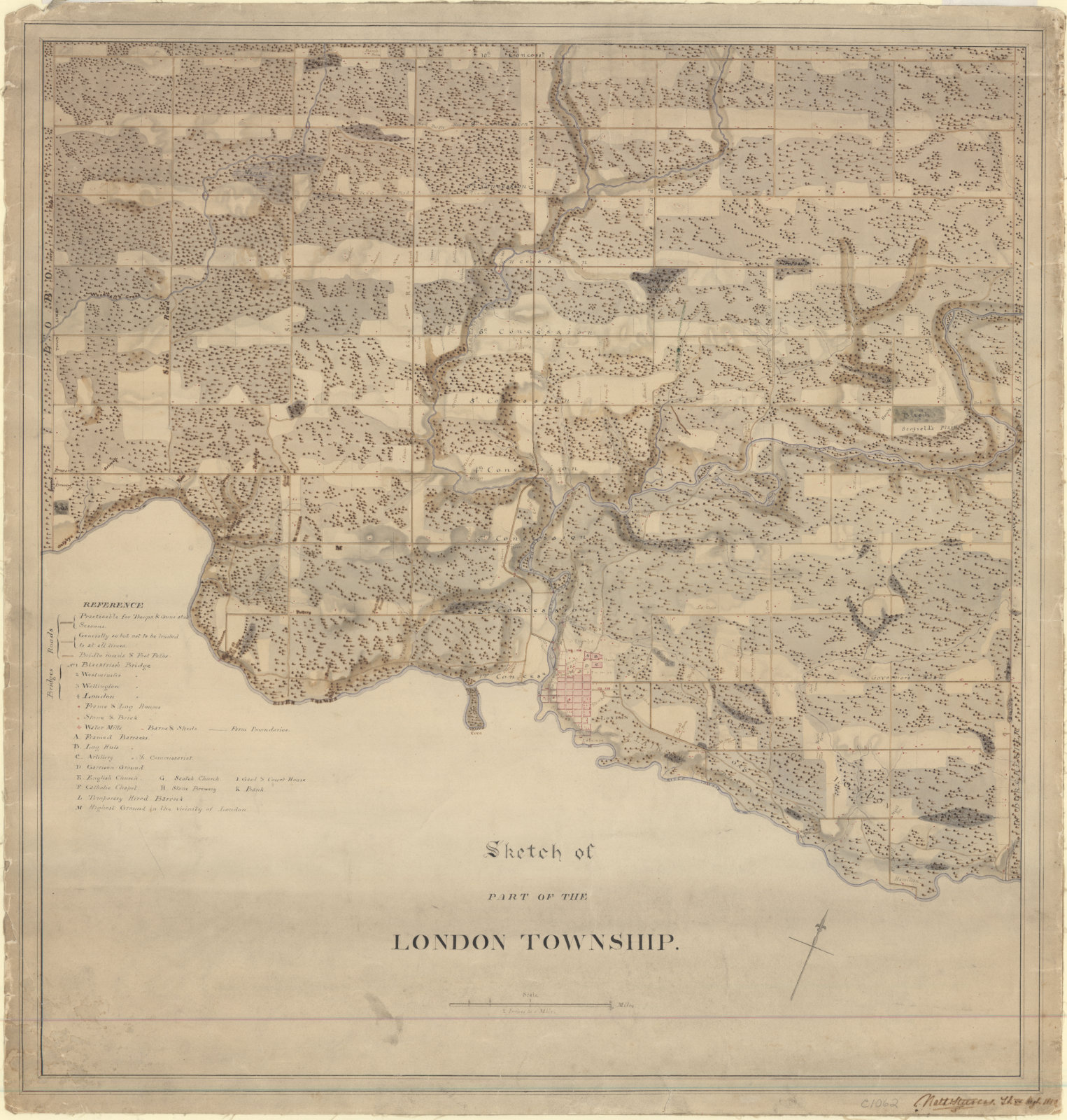
| Description |
English: Sketch of part of the London Township with references for roads (including road quality, e.g. "Practicable for Troops & Guns at all Seasons"), bridges, houses, farms (with owners' names), churches, barracks and artillery, businesses, etc. |
| Date | |
| Source |
This map was digitized on February 24, 2016 by the Western Libraries Map and Data Centre at [https://en.wikipedia.org/wiki/University_of_Western_Ontario Western University] For details about the original, visit the [1]” |
| Creator |
Nath. Steevens |
| Geotemporal data | |
| Map location | London |
| Georeferencing | If inappropriate please set warp_status = skip to hide. |
| Archival data | |
| Collection | University of Western Ontario |
Licensing
edit
|
This work is in the public domain in its country of origin and other countries and areas where the copyright term is the author's life plus 70 years or fewer. This work is in the public domain in the United States because it was published (or registered with the U.S. Copyright Office) before January 1, 1929. | |
| This file has been identified as being free of known restrictions under copyright law, including all related and neighboring rights. | |
File history
Click on a date/time to view the file as it appeared at that time.
| Date/Time | Thumbnail | Dimensions | User | Comment | |
|---|---|---|---|---|---|
| current | 17:14, 3 March 2020 | | 1,525 × 1,600 (562 KB) | Jvankeulen (talk | contribs) | User created page with UploadWizard |
You cannot overwrite this file.
File usage on Commons
The following page uses this file:
File usage on other wikis
The following other wikis use this file:
- Usage on www.wikidata.org