File:Snetterton 1965 versus 2011.svg

Size of this PNG preview of this SVG file: 647 × 600 pixels. Other resolutions: 259 × 240 pixels | 518 × 480 pixels | 829 × 768 pixels | 1,105 × 1,024 pixels | 2,209 × 2,048 pixels | 794 × 736 pixels.
Original file (SVG file, nominally 794 × 736 pixels, file size: 434 KB)
Captions
Captions
Add a one-line explanation of what this file represents
Summary edit
| Description |
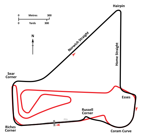
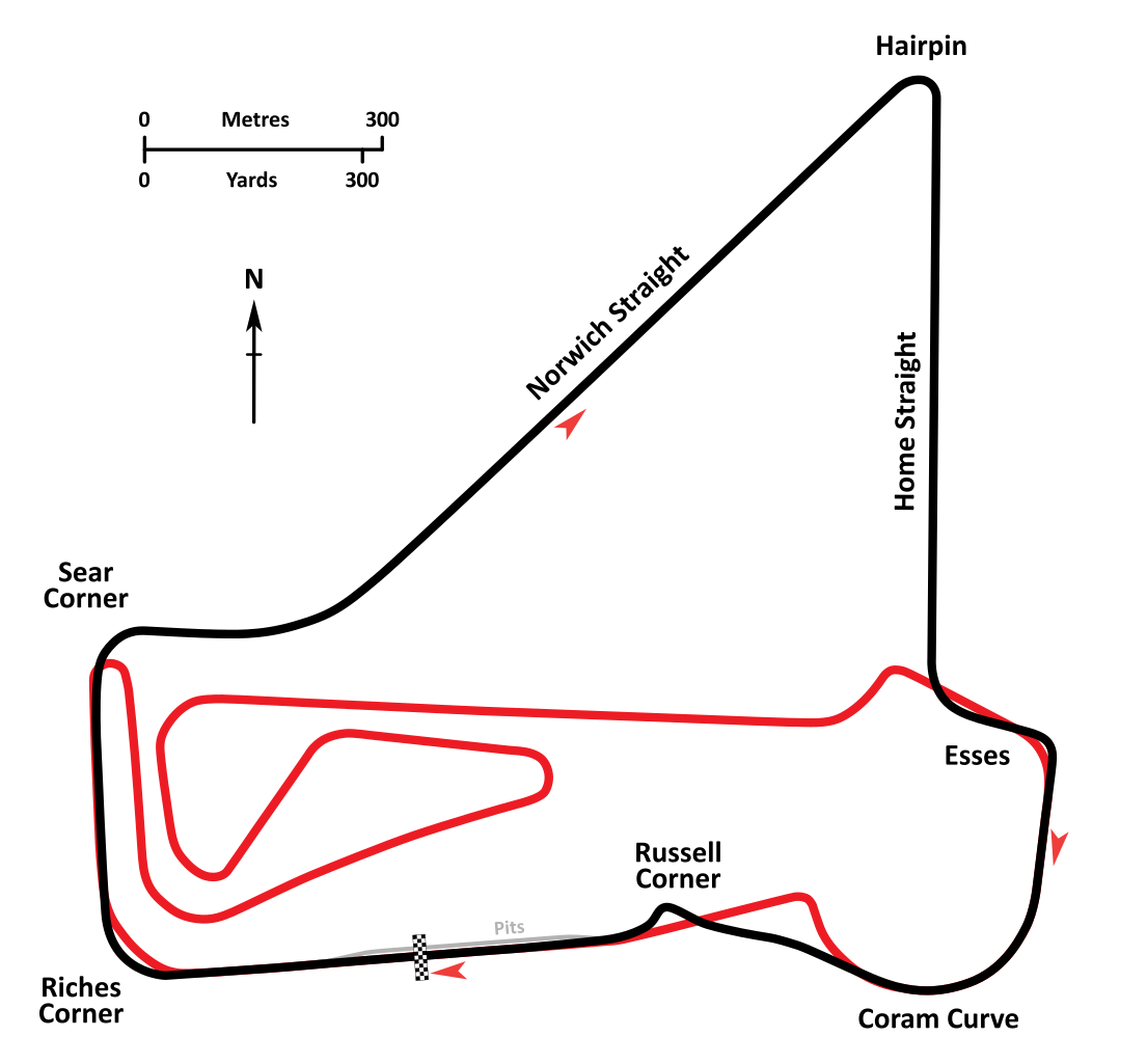
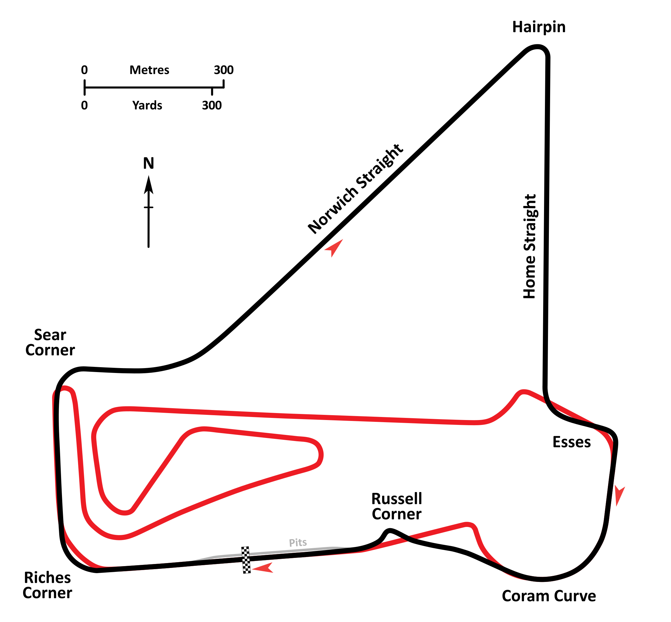
English: An annotated diagrammatic map of the Snetterton Circuit as it was configured circa 1965, in approximately its original form but with the addition of the chicane at Russell in place of Paddock Bend. The modern 300 Circuit, developed in 2011, is shown in red, behind. Circuit cartography is derived from RAF and USAAF aerial photography taken in 1946-1947 and contemporary Ordnance Survey plans. Circuit layout and corner names are per diagrams printed in contemporary race programs. |
| Date | |
| Source | Own work |
| Author | John Chapman |
Licensing edit
I, the copyright holder of this work, hereby publish it under the following license:
This file is licensed under the Creative Commons Attribution-Share Alike 4.0 International license.
- You are free:
- to share – to copy, distribute and transmit the work
- to remix – to adapt the work
- Under the following conditions:
- attribution – You must give appropriate credit, provide a link to the license, and indicate if changes were made. You may do so in any reasonable manner, but not in any way that suggests the licensor endorses you or your use.
- share alike – If you remix, transform, or build upon the material, you must distribute your contributions under the same or compatible license as the original.
File history
Click on a date/time to view the file as it appeared at that time.
| Date/Time | Thumbnail | Dimensions | User | Comment | |
|---|---|---|---|---|---|
| current | 01:48, 15 May 2015 | | 794 × 736 (434 KB) | Pyrope (talk | contribs) | Correction to Russell profile. |
| 04:54, 12 May 2015 |  | 794 × 708 (908 KB) | Pyrope (talk | contribs) | User created page with UploadWizard |
You cannot overwrite this file.
File usage on Commons
The following page uses this file: