File:Sobótka (gmina) location map.png

Original file (890 × 1,043 pixels, file size: 452 KB, MIME type: image/png)
Captions
Captions
Summary edit
_location_map.png&action=edit§ion=1)
| Description |
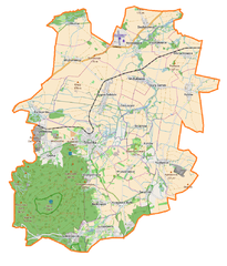
English: Location map |
| Date | |
| Source | Own work |
| Author | Smat |
| Description |
Polski: Mapa gminy Sobótka, Polska
English: Map of Sobótka (gmina), Poland |
|||||||||
| Date | ||||||||||
| Source | You may find a page on the OpenStreetMap wiki page for Sobótka (gmina) | |||||||||
| Creator |
OpenStreetMap contributors OpenStreetMap contributors |
|||||||||
| Permission (Reusing this file) |
OpenStreetMap data is available under the Open Database License (details). Map tiles are licensed under the Creative Commons Attribution-ShareAlike 2.0 license (CC-BY-SA 2.0).
This file is licensed under the Creative Commons Attribution-Share Alike 2.0 Generic license.
|
|||||||||
| Geotemporal data | ||||||||||
| Bounding box |
|
|||||||||
| Georeferencing | If inappropriate please set warp_status = skip to hide. | |||||||||
Licensing edit
_location_map.png&action=edit§ion=2)
| This work contains information from OpenStreetMap, which is made available under the Open Database License (ODbL).
The ODbL does not require any particular license for maps produced from ODbL data. Prior to 1 August 2020, map tiles produced by the OpenStreetMap Foundation were licensed under the CC-BY-SA-2.0 license. Maps produced by other people may be subject to other licences. |
File history
Click on a date/time to view the file as it appeared at that time.
| Date/Time | Thumbnail | Dimensions | User | Comment | |
|---|---|---|---|---|---|
| current | 16:48, 14 February 2017 | | 890 × 1,043 (452 KB) | Smat (talk | contribs) | User created page with UploadWizard |
You cannot overwrite this file.
File usage on Commons
There are no pages that use this file.
File usage on other wikis
The following other wikis use this file:
- Usage on de.wikipedia.org
- Usage on pl.wikipedia.org
- Ślęża
- Rogów Sobócki
- Sobótka (miasto)
- Sobótka (gmina)
- Niedźwiedź (posąg)
- Garncarsko (województwo dolnośląskie)
- Kryształowice
- Księginice Małe
- Olbrachtowice
- Przezdrowice
- Ręków
- Siedlakowice
- Stary Zamek
- Sulistrowiczki
- Strzegomiany
- Wojnarowice
- Żerzuszyce
- Będkowice (województwo dolnośląskie)
- Mirosławice (województwo dolnośląskie)
- Nasławice (województwo dolnośląskie)
- Okulice (województwo dolnośląskie)
- Sulistrowice (województwo dolnośląskie)
- Kunów (powiat wrocławski)
- Strachów (powiat wrocławski)
- Świątniki (powiat wrocławski)
- Michałowice (gmina Sobótka)
- Panna z rybą
- Rezerwat przyrody Góra Ślęża
- Rezerwat przyrody Łąka Sulistrowicka
- Zespół przyrodniczo-krajobrazowy „Skalna”
- Górka (Sobótka)
- Przemiłów
- RTCN Ślęża
- Sulistrowicki Potok
- Wieża Bismarcka na Wieżycy
- Sobótka (stacja kolejowa)
- Parafia św. Jakuba Apostoła w Sobótce
- Parafia Najświętszego Serca Pana Jezusa w Sobótce
- Sobótka Zachodnia
- Lądowisko Mirosławice
- Olbrachtowice (przystanek kolejowy)
- Rogów Sobócki (przystanek kolejowy)
- Muzeum Ślężańskie im. Stanisława Dunajewskiego w Sobótce
- Parafia św. Józefa Oblubieńca Najświętszej Maryi Panny w Nasławicach
- Parafia św. Jana Chrzciciela w Rogowie Sobóckim
- Parafia św. Stanisława Biskupa i Męczennika w Starym Zamku
- Parafia Najświętszego Serca Pana Jezusa w Sulistrowicach
- Pałac w Sobótce-Górce
- Browar Sobótka-Górka
View more global usage of this file.
_location_map.png)
_location_map.png&oldid=607600959)