File:Sokółka (gmina) location map.png

Size of this preview: 638 × 600 pixels. Other resolutions: 255 × 240 pixels | 511 × 480 pixels | 820 × 771 pixels.
Original file (820 × 771 pixels, file size: 166 KB, MIME type: image/png)
Captions
Captions
Add a one-line explanation of what this file represents
| Description |
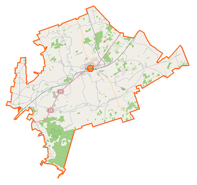
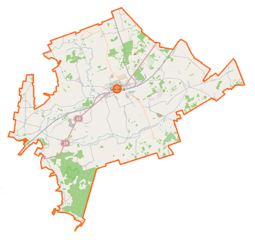
Polski: Mapa gminy Sokółka, Polska
English: Map of Gmina Sokółka, Poland |
|||||||||
| Date | ||||||||||
| Source | You may find a page on the OpenStreetMap wiki page for Sokółka (gmina) | |||||||||
| Creator |
OpenStreetMap contributors OpenStreetMap contributors |
|||||||||
| Permission (Reusing this file) |
OpenStreetMap data is available under the Open Database License (details). Map tiles are licensed under the Creative Commons Attribution-ShareAlike 2.0 license (CC-BY-SA 2.0).
This file is licensed under the Creative Commons Attribution-Share Alike 2.0 Generic license.
|
|||||||||
| Geotemporal data | ||||||||||
| Bounding box |
|
|||||||||
| Georeferencing | If inappropriate please set warp_status = skip to hide. | |||||||||
File history
Click on a date/time to view the file as it appeared at that time.
| Date/Time | Thumbnail | Dimensions | User | Comment | |
|---|---|---|---|---|---|
| current | 10:12, 16 September 2014 | | 820 × 771 (166 KB) | VanWiel (talk | contribs) | {{Information |Description= |Source= |Date= |Author= |Permission= |other_versions= }} |
| 08:17, 25 June 2014 |  | 820 × 771 (243 KB) | VanWiel (talk | contribs) | {{OpenStreetMap | name = Sokółka (gmina) | location = Sokółka (gmina) | description = {{pl|Mapa gminy Sokółka, Polska}} {{en|Map of Gmina Sokółka, Poland}} | top = 53.4983 | left = 23.2917... |
You cannot overwrite this file.
File usage on Commons
There are no pages that use this file.
File usage on other wikis
The following other wikis use this file:
- Usage on id.wikipedia.org
- Usage on pl.wikipedia.org
- Sokółka
- Bohoniki
- Sokółka (gmina)
- Rezerwat przyrody Kozłowy Ług
- Bachmatówka
- Bilwinki
- Drahle
- Dworzysk (gmina Sokółka)
- Geniusze
- Gliniszcze Małe
- Gliniszcze Wielkie
- Hałe
- Igryły
- Janowszczyzna
- Kraśniany
- Kurowszczyzna
- Kuryły (powiat sokólski)
- Kantorówka
- Malawicze Dolne
- Malawicze Górne
- Miejskie Nowiny
- Nomiki
- Nowa Rozedranka
- Orłowicze
- Planteczka
- Podkamionka (województwo podlaskie)
- Poniatowicze
- Puciłki
- Sierbowce
- Sokolany
- Szyndziel
- Słojniki
- Stary Szor
- Stara Moczalnia
- Stara Rozedranka
- Straż (powiat sokólski)
- Wierzchjedlina
- Wojnachy
- Woroniany
- Wysokie Laski
- Zadworzany
- Zaśpicze
- Zawistowszczyzna
- Jelenia Góra (województwo podlaskie)
- Lipina (województwo podlaskie)
- Polanki (województwo podlaskie)
- Smolanka (województwo podlaskie)
- Szyszki (województwo podlaskie)
View more global usage of this file.
_location_map.png)
_location_map.png&oldid=504989501)