File:Sorae Salt Field 1946.png
Size of this preview: 600 × 600 pixels. Other resolutions: 240 × 240 pixels | 480 × 480 pixels | 768 × 768 pixels | 1,024 × 1,024 pixels | 2,000 × 2,000 pixels.
Original file (2,000 × 2,000 pixels, file size: 9.16 MB, MIME type: image/png)
Captions
Captions
Add a one-line explanation of what this file represents
Summary
edit
| Description |
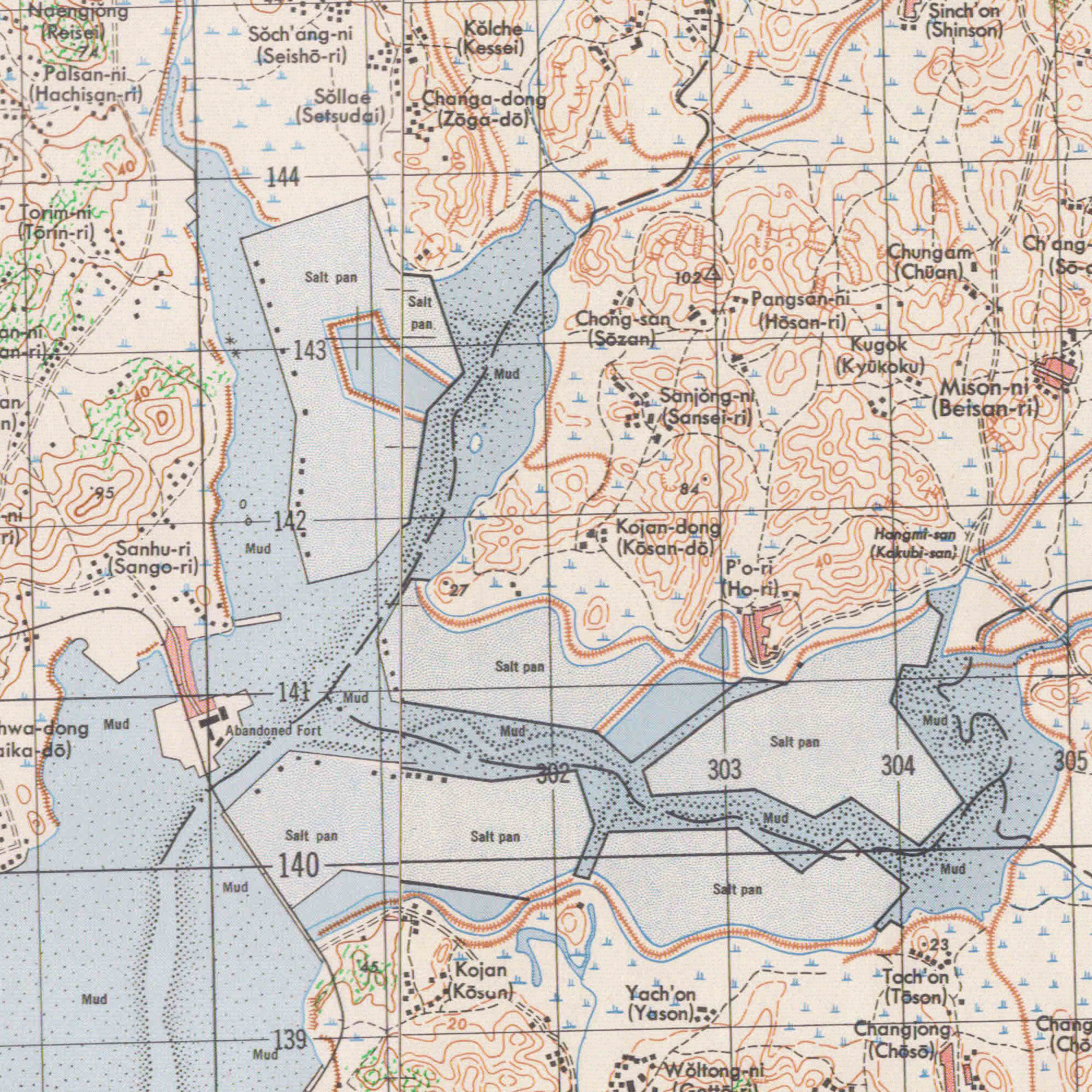
한국어: 미군에서 제작한 1946년 인천/경기 지도 일부분.
English: 1946 Map of Inchon/Kyonggi, South Korea by the Army Map Service, U.S. Army |
| Date | |
| Source | AMS L751 Topographic Maps: Map Sheet L751 - 6526 |
| Author | Army Map Service, U.S. Army. |
Licensing
edit
This file is a work of a U.S. Army soldier or employee, taken or made as part of that person's official duties. As a work of the U.S. federal government, it is in the public domain in the United States.
|
 |
File history
Click on a date/time to view the file as it appeared at that time.
| Date/Time | Thumbnail | Dimensions | User | Comment | |
|---|---|---|---|---|---|
| current | 18:09, 17 May 2020 | | 2,000 × 2,000 (9.16 MB) | 오모군 (talk | contribs) | Uploaded a work by Army Map Service, U.S. Army. from U.S. Army. with UploadWizard |
You cannot overwrite this file.
File usage on Commons
The following page uses this file:
File usage on other wikis
The following other wikis use this file:
- Usage on ko.wikipedia.org