File:Sortavalan kaupungin asema-kartta 1901.jpg

Size of this preview: 581 × 600 pixels. Other resolutions: 232 × 240 pixels | 465 × 480 pixels | 803 × 829 pixels.
Original file (803 × 829 pixels, file size: 147 KB, MIME type: image/jpeg)
Captions
Captions
Add a one-line explanation of what this file represents
Summary
edit
| Description |
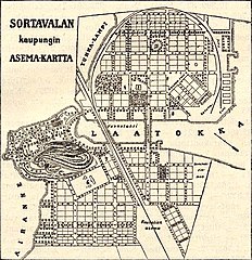
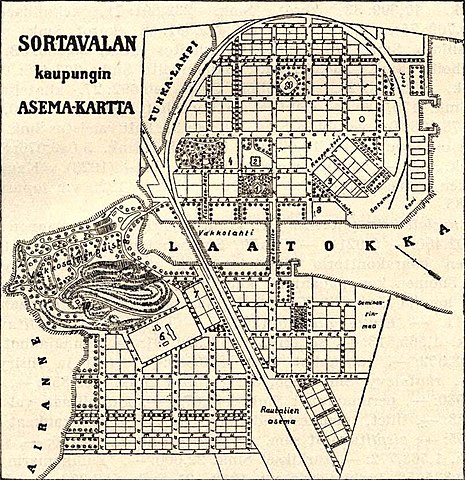
Русский: Карта Сортавалы 1901 года.
English: 1901 map of Sortavala.
Suomi: Sortavalan kaupungin asema-kartta, tehty 1901. |
| Date | |
| Source | [1] |
| Author | Unknown author |
Licensing
edit
|
This work is in the public domain in its country of origin and other countries and areas where the copyright term is the author's life plus 100 years or fewer. This work is in the public domain in the United States because it was published (or registered with the U.S. Copyright Office) before January 1, 1929. | |
| This file has been identified as being free of known restrictions under copyright law, including all related and neighboring rights. | |
File history
Click on a date/time to view the file as it appeared at that time.
| Date/Time | Thumbnail | Dimensions | User | Comment | |
|---|---|---|---|---|---|
| current | 03:26, 5 November 2021 | | 803 × 829 (147 KB) | Красный (talk | contribs) | Uploaded a work by {{unknown|author}} from [http://heninen.net/sortavala/1901/] with UploadWizard |
You cannot overwrite this file.
File usage on Commons
There are no pages that use this file.