File:South Asia historical AD550 es.svg

Size of this PNG preview of this SVG file: 614 × 600 pixels. Other resolutions: 246 × 240 pixels | 492 × 480 pixels | 786 × 768 pixels | 1,049 × 1,024 pixels | 2,097 × 2,048 pixels | 1,280 × 1,250 pixels.
Original file (SVG file, nominally 1,280 × 1,250 pixels, file size: 442 KB)
Captions
Captions
Add a one-line explanation of what this file represents
Summary edit
| Description |
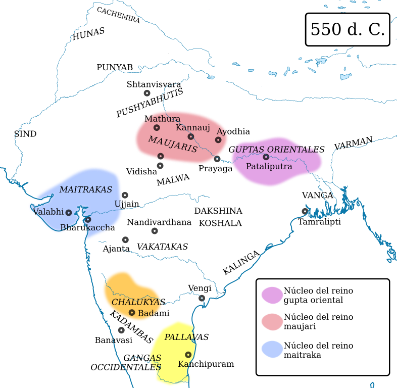
English: Political map of South Asia around 625 AD. The dominant powers were Harsha's Empire in the north, Gauda (Bengal) in the east, and the Chalukyas in the south. The smaller dynasties allied themselves with these: the Maitrakas and Varmans were allied with Harsha against, respectively, the Chalukyas and Gauda. In the extreme south, the Pallavas of Kanchipuram were dominant.
Sources:
|
| Source |
This file was derived from: South Asia historical AD550 EN.svg: |
| Author | Woudloper, Rowanwindwhistler |
Licensing edit
This file is licensed under the Creative Commons Attribution-Share Alike 4.0 International license.
- You are free:
- to share – to copy, distribute and transmit the work
- to remix – to adapt the work
- Under the following conditions:
- attribution – You must give appropriate credit, provide a link to the license, and indicate if changes were made. You may do so in any reasonable manner, but not in any way that suggests the licensor endorses you or your use.
- share alike – If you remix, transform, or build upon the material, you must distribute your contributions under the same or compatible license as the original.
File history
Click on a date/time to view the file as it appeared at that time.
| Date/Time | Thumbnail | Dimensions | User | Comment | |
|---|---|---|---|---|---|
| current | 15:55, 11 July 2019 | | 1,280 × 1,250 (442 KB) | Rowanwindwhistler (talk | contribs) | Uploading a file from a free published source using File Upload Wizard |
You cannot overwrite this file.
File usage on Commons
There are no pages that use this file.