File:South Korean legislative election map (2020).svg

Size of this PNG preview of this SVG file: 424 × 599 pixels. Other resolutions: 170 × 240 pixels | 340 × 480 pixels | 544 × 768 pixels | 725 × 1,024 pixels | 1,450 × 2,048 pixels | 512 × 723 pixels.
Original file (SVG file, nominally 512 × 723 pixels, file size: 684 KB)
Captions
Captions
Add a one-line explanation of what this file represents
| Description |
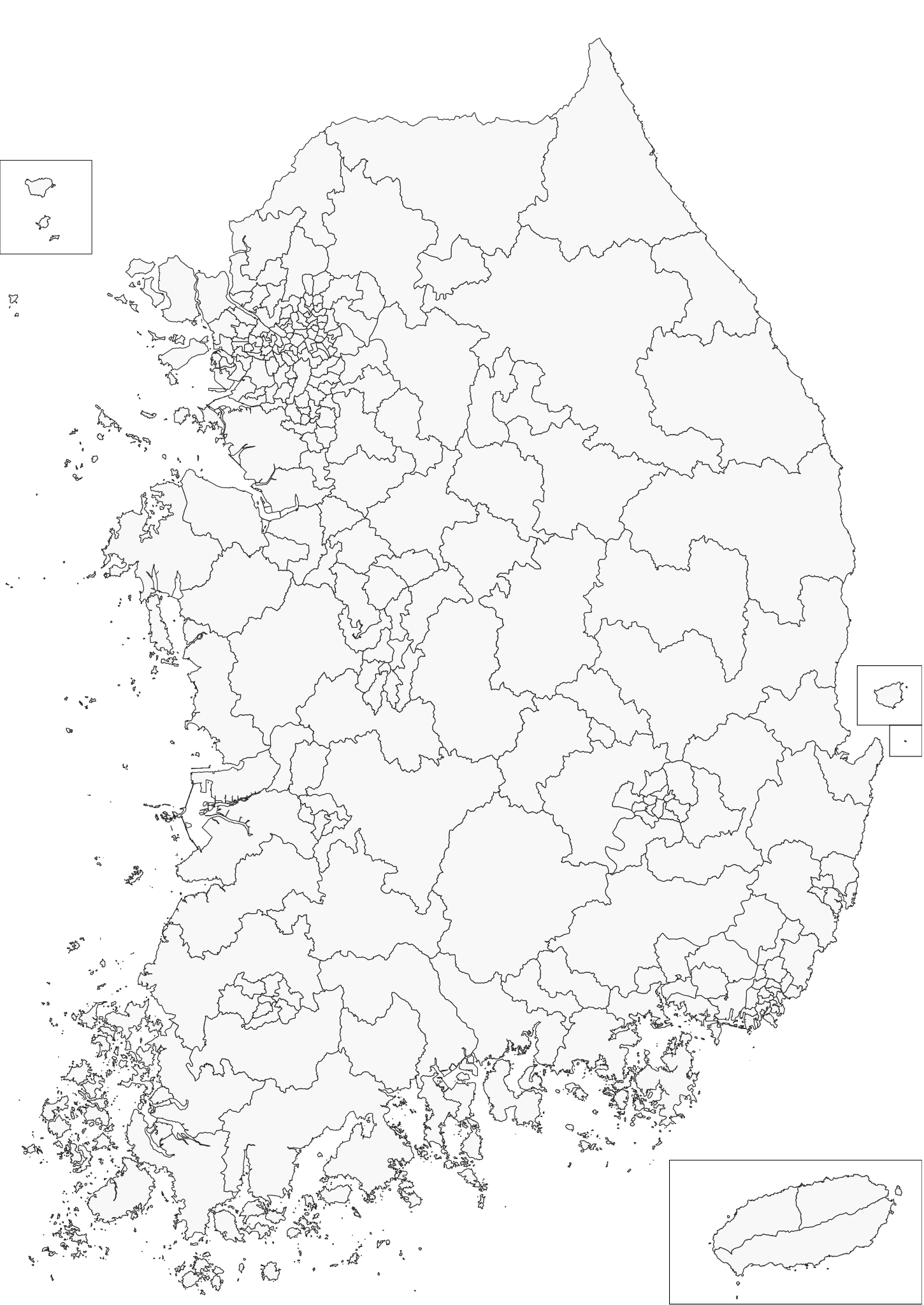
English: Map of electoral districts for legislative election of South Korea, 2020 |
|||
| Date | ||||
| Source | openstreetmap.org | |||
| Creator |
OpenStreetMap contributors |
|||
| Permission (Reusing this file) |
OpenStreetMap data is available under the Open Database License (details). Map tiles are licensed under the Creative Commons Attribution-ShareAlike 2.0 license (CC-BY-SA 2.0).
This file is licensed under the Creative Commons Attribution-Share Alike 2.0 Generic license.
|
|||
| Georeferencing | If inappropriate please set warp_status = skip to hide. |
This W3C-unspecified vector image was created with QGIS.
File history
Click on a date/time to view the file as it appeared at that time.
| Date/Time | Thumbnail | Dimensions | User | Comment | |
|---|---|---|---|---|---|
| current | 11:21, 17 April 2020 | | 512 × 723 (684 KB) | D6283 (talk | contribs) | Fixed one electoral district. |
| 06:21, 15 April 2020 |  | 512 × 723 (684 KB) | D6283 (talk | contribs) | Changed colour scheme. Map with results will be uploaded this Saturday | |
| 11:05, 13 March 2020 |  | 795 × 1,123 (673 KB) | D6283 (talk | contribs) | Uploaded a work by ..... from ..... with UploadWizard |
You cannot overwrite this file.
File usage on Commons
The following 2 pages use this file:
.svg&oldid=727014939)