File:Southeast wildfires (cropped).jpg

Size of this preview: 374 × 599 pixels. Other resolutions: 150 × 240 pixels | 299 × 480 pixels | 479 × 768 pixels | 639 × 1,024 pixels | 1,278 × 2,048 pixels | 3,585 × 5,746 pixels.
Original file (3,585 × 5,746 pixels, file size: 3.94 MB, MIME type: image/jpeg)
Captions
Captions
Add a one-line explanation of what this file represents
Summary edit
| Description |
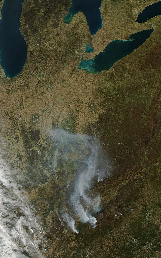
English: Satellite photo taken on November 7, 2016, showing wildfires burning in the U.S. states of Georgia, North Carolina, Tennessee, and Kentucky. |
| Date | |
| Source | https://earthobservatory.nasa.gov/images/89103/drought-and-fire-in-the-southeast |
| Author | NASA - NASA Earth Observatory |
| Other versions |

.jpg&action=edit§ion=1)
Licensing edit
.jpg&action=edit§ion=2)
| This file is in the public domain in the United States because it was solely created by NASA. NASA copyright policy states that "NASA material is not protected by copyright unless noted". (See Template:PD-USGov, NASA copyright policy page or JPL Image Use Policy.) | ||
 |
Warnings:
|
File history
Click on a date/time to view the file as it appeared at that time.
| Date/Time | Thumbnail | Dimensions | User | Comment | |
|---|---|---|---|---|---|
| current | 23:08, 22 August 2022 | | 3,585 × 5,746 (3.94 MB) | Blythwood (talk | contribs) | File:Southeast wildfires.jpg cropped 28 % horizontally, 18 % vertically using CropTool with lossless mode. |
You cannot overwrite this file.
File usage on Commons
The following page uses this file:
File usage on other wikis
The following other wikis use this file:
- Usage on en.wikipedia.org
.jpg&oldid=691164120)