File:Southeastern United States (MODIS 2019-01-21).jpg

Size of this preview: 745 × 600 pixels. Other resolutions: 298 × 240 pixels | 596 × 480 pixels | 954 × 768 pixels | 1,272 × 1,024 pixels | 2,544 × 2,048 pixels | 3,753 × 3,022 pixels.
Original file (3,753 × 3,022 pixels, file size: 1.47 MB, MIME type: image/jpeg)
Captions
Captions
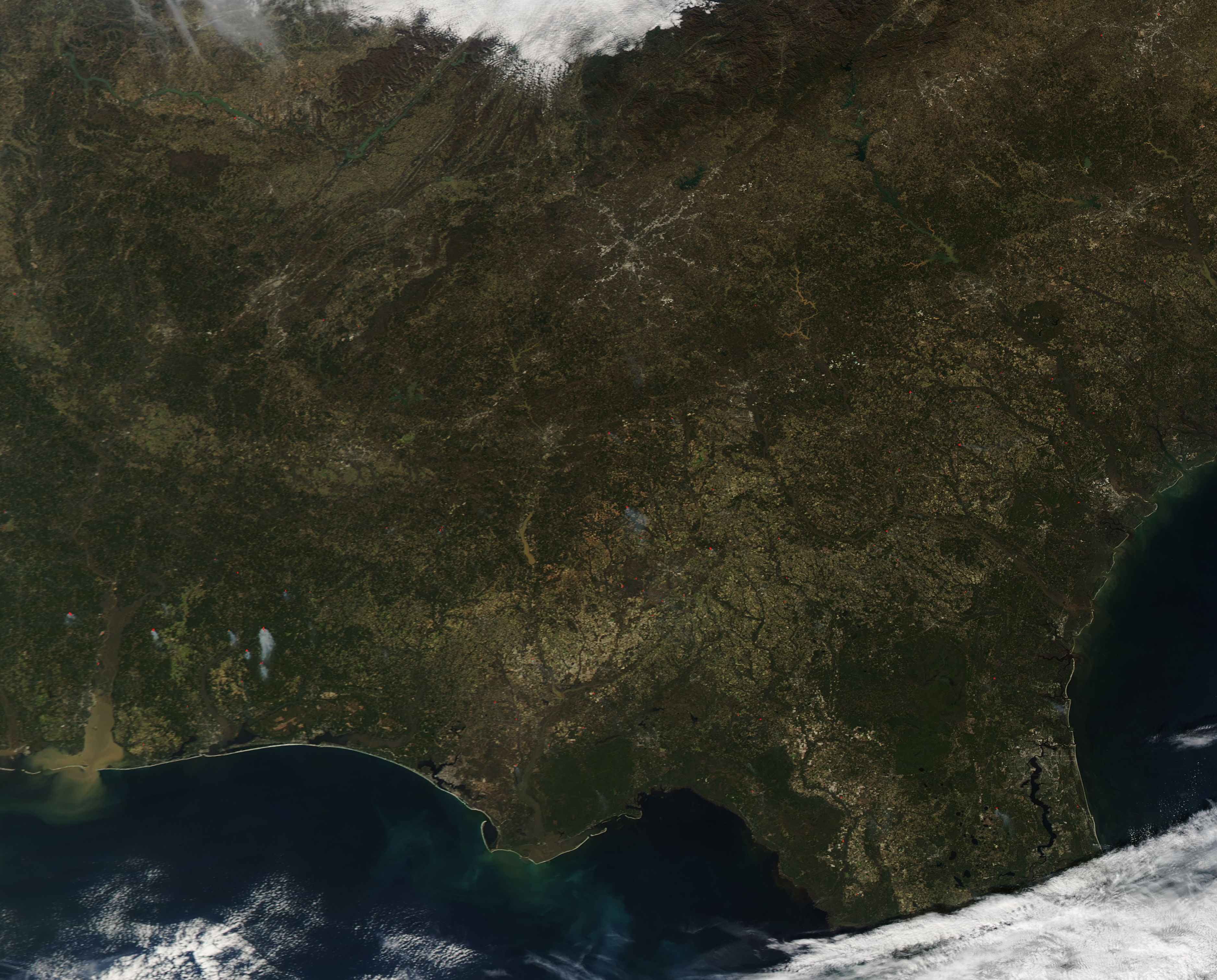
On January 16, 2019, the Moderate Resolution Imaging Spectroradiometer (MODIS) on board NASA’s Aqua satellite acquired a true-color image of the Southeastern United States.
Summary
edit.jpg&action=edit§ion=1)
| Description |
English: On January 16, 2019, the Moderate Resolution Imaging Spectroradiometer (MODIS) on board NASA’s Aqua satellite acquired a true-color image of the Southeastern United States. This broad view of a winter’s day includes six states. From west to east and north to south they are: Tennessee, North Carolina, Alabama, North Carolina, South Carolina, and northern Florida.
Several notable features are easily seen from space. The gray pixels that mark the Atlanta, Georgia metro area expand outward from the center in a sprawling, spider web-like pattern. To the northwest of Atlanta, waving folds of green and tan mark the Appalachian Mountains which stretch to the northeast from Cheaha Mountain in Alabama to Belle Island, Canada. In the southwest, a thick band of muddy water pours from Mobile Bay into the Gulf of Mexico. Heavy rains have filled both the Alabama River and the Tombigbee this winter, bringing them well above flood stage. Both rivers pour into the northern point of the Mobile-Tensaw Delta, creating flood conditions there as well. Local reports reported that in early January, heavy rains had transformed the Delta into a 13-mile-wide river as the Alabama River crested at 50.8 feet at the Claiborne Dam, one of the highest levels recorded since 1972, the year the dam was built. On January 20, the National Weather Service published warnings for continued flooding in many of Alabama’s rivers. |
||
| Date | Taken on 16 January 2019 | ||
| Source |
Southeastern United States (direct link)
|
||
| Author | MODIS Land Rapid Response Team, NASA GSFC |
| This media is a product of the Aqua mission Credit and attribution belongs to the mission team, if not already specified in the "author" row |
Licensing
edit.jpg&action=edit§ion=2)
| This file is in the public domain in the United States because it was solely created by NASA. NASA copyright policy states that "NASA material is not protected by copyright unless noted". (See Template:PD-USGov, NASA copyright policy page or JPL Image Use Policy.) | ||
 |
Warnings:
|
File history
Click on a date/time to view the file as it appeared at that time.
| Date/Time | Thumbnail | Dimensions | User | Comment | |
|---|---|---|---|---|---|
| current | 03:33, 17 February 2024 | | 3,753 × 3,022 (1.47 MB) | OptimusPrimeBot (talk | contribs) | #Spacemedia - Upload of http://modis.gsfc.nasa.gov/gallery/images/image01212019_250m.jpg via Commons:Spacemedia |
You cannot overwrite this file.
File usage on Commons
There are no pages that use this file.
.jpg&oldid=852929489)