File:Southeastern United States (MODIS 2020-05-05).jpg

Size of this preview: 665 × 600 pixels. Other resolutions: 266 × 240 pixels | 532 × 480 pixels | 852 × 768 pixels | 1,136 × 1,024 pixels | 2,271 × 2,048 pixels | 6,641 × 5,989 pixels.
Original file (6,641 × 5,989 pixels, file size: 4.25 MB, MIME type: image/jpeg)
Captions
Captions
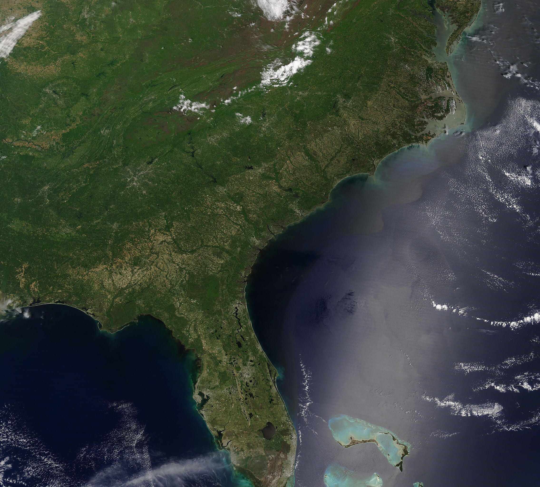
On May 2, 2020, the Moderate Resolution Imaging Spectroradiometer (MODIS) on board the Terra satellite acquired a true-color image that gave a sweeping view of springtime across the Southeastern United States.
Summary
edit.jpg&action=edit§ion=1)
| Description |
English: On May 2, 2020, the Moderate Resolution Imaging Spectroradiometer (MODIS) on board the Terra satellite acquired a true-color image that gave a sweeping view of springtime across the Southeastern United States.
Cloud hangs over part of the Appalachian Mountains, which stretch approximately 1,500 miles (2,400 km) from Newfoundland, Canada to Alabama, United States. Although a relatively low mountain chain, the Appalachians are one of the oldest mountains chains in the world. The rocks that form these mountains are estimated to be 540 to 300 million years old. The Blue Ridge Mountains are the eastern-most section of the greater Appalachians. The Cumberland Plateau sits west of the Appalachians, rising more than 1,000 feet across eastern Tennessee, Alabama, and north into Kentucky. Once a remote virgin forest built on rock-strewn ridges and steep green ravines, this area marks one of the world’s longest expanse of hardwood-forested plateau. East of the Blue Ridge Mountains the rolling Piedmont region stretches to the lowlands of the Coastal Plain. The Coastal Plain is a rich agricultural region, so it’s no surprise that much of it appears tan as fields and croplands are renewed at the start of a new growing season. |
||
| Date | Taken on 2 May 2020 | ||
| Source |
Southeastern United States (direct link)
|
||
| Author | MODIS Land Rapid Response Team, NASA GSFC |
| This media is a product of the Terra mission Credit and attribution belongs to the mission team, if not already specified in the "author" row |
Licensing
edit.jpg&action=edit§ion=2)
| This file is in the public domain in the United States because it was solely created by NASA. NASA copyright policy states that "NASA material is not protected by copyright unless noted". (See Template:PD-USGov, NASA copyright policy page or JPL Image Use Policy.) | ||
 |
Warnings:
|
File history
Click on a date/time to view the file as it appeared at that time.
| Date/Time | Thumbnail | Dimensions | User | Comment | |
|---|---|---|---|---|---|
| current | 03:07, 17 February 2024 | | 6,641 × 5,989 (4.25 MB) | OptimusPrimeBot (talk | contribs) | #Spacemedia - Upload of http://modis.gsfc.nasa.gov/gallery/images/image05052020_250m.jpg via Commons:Spacemedia |
You cannot overwrite this file.
File usage on Commons
There are no pages that use this file.
.jpg&oldid=909381002)