File:Southern-Kuril-Islands-ISS-Space.png

Size of this preview: 800 × 450 pixels. Other resolutions: 320 × 180 pixels | 640 × 360 pixels | 1,024 × 576 pixels | 1,280 × 720 pixels | 1,920 × 1,080 pixels.
Original file (1,920 × 1,080 pixels, file size: 1.75 MB, MIME type: image/png)
Captions
Captions
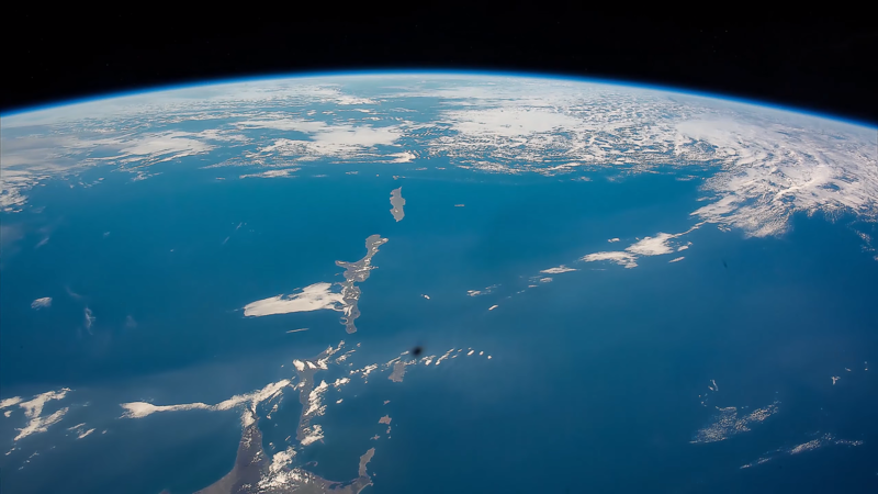
Southern Kuril islands: Habomai Islands, Shikotan, Kunashiri (Kunashir), Etorofu (Iturup), Uruppu (Urup) and the northeastern tip of Hokkaido, seen from the International Space Station (17 October 2015).
Summary edit
| Description |
English: Southern Kuril islands: Habomai Islands, Shikotan, Kunashiri (Kunashir), Etorofu (Iturup), Uruppu (Urup) and the northeastern tip of Hokkaido, seen from the International Space Station (17 October 2015).
日本語: 千島列島(北方領土問題):国際宇宙ステーションから見た歯舞群島、色丹島、国後島、択捉島、得撫島(2015年10月17日) |
| Date | |
| Source | http://eol.jsc.nasa.gov/ video: ISS Timelapse - Riding clouds up to Japan (17 Ottobre 2015) link: https://www.youtube.com/watch?v=wiI8eJivNqg |
| Author | NASA, International Space Station |
Licensing edit
| This file is in the public domain in the United States because it was solely created by NASA. NASA copyright policy states that "NASA material is not protected by copyright unless noted". (See Template:PD-USGov, NASA copyright policy page or JPL Image Use Policy.) | ||
 |
Warnings:
|
File history
Click on a date/time to view the file as it appeared at that time.
| Date/Time | Thumbnail | Dimensions | User | Comment | |
|---|---|---|---|---|---|
| current | 20:16, 22 October 2020 | | 1,920 × 1,080 (1.75 MB) | Artanisen (talk | contribs) | Uploaded a work by NASA, International Space Station from http://eol.jsc.nasa.gov/ video: ISS Timelapse - Riding clouds up to Japan (17 Ottobre 2015) link: https://www.youtube.com/watch?v=wiI8eJivNqg with UploadWizard |
You cannot overwrite this file.
File usage on Commons
The following page uses this file:
File usage on other wikis
The following other wikis use this file:
- Usage on en.wikipedia.org
- Usage on id.wikipedia.org
- Usage on ja.wikipedia.org
- Usage on ko.wikipedia.org
- Usage on ru.wikipedia.org
- Usage on uk.wikipedia.org
- Usage on vi.wikipedia.org