File:SouthernAfrica1880s.svg

Size of this PNG preview of this SVG file: 800 × 400 pixels. Other resolutions: 320 × 160 pixels | 640 × 320 pixels | 1,024 × 512 pixels | 1,280 × 640 pixels | 2,560 × 1,280 pixels | 1,000 × 500 pixels.
Original file (SVG file, nominally 1,000 × 500 pixels, file size: 2.72 MB)
Captions
Captions
Add a one-line explanation of what this file represents
Summary edit
| Description |
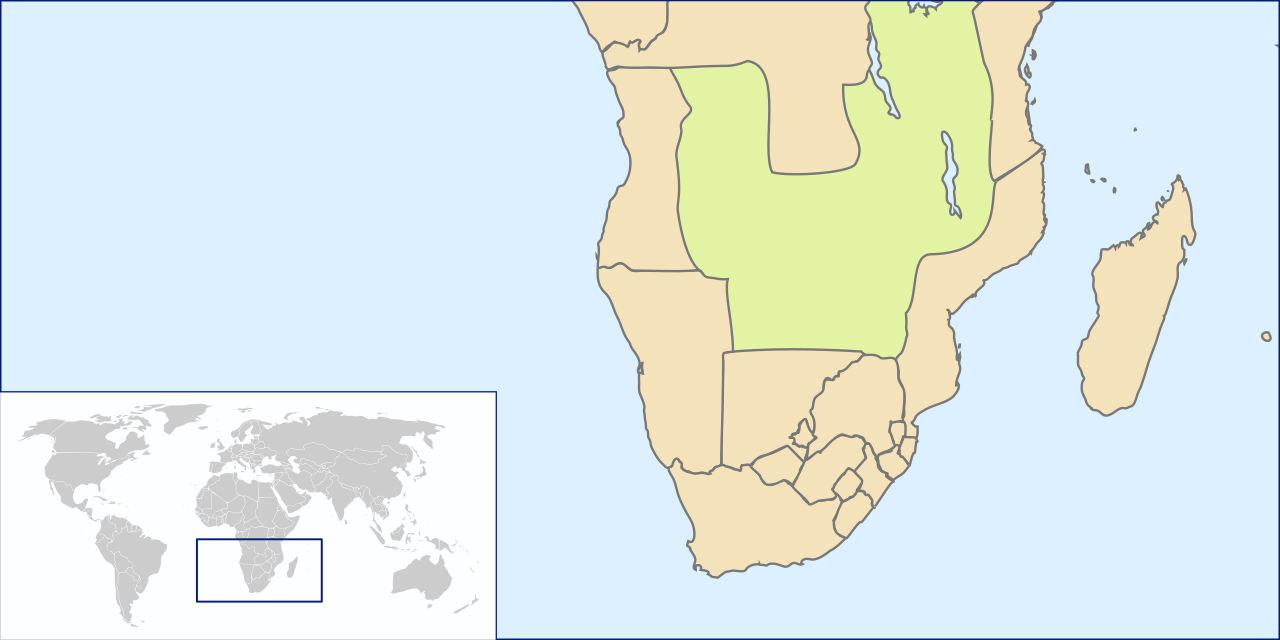
Afrikaans: Afrika suid van die ewenaar, met politieke grense van die 1880s. Die Berlynse Koloniale Konferensie van 1884 was verantwoordelik vir die onderlinge afbakening en beslissing van koloniale gebiedsaansprake.
English: Africa south of the equator, with the political boundaries of the 1880s. The Berlin Conference of 1884 was responsible for outlining and adjudicating the colonial territorial claims. |
| Date | |
| Source | Own work by uploader based on File:SouthAfrica1885.jpg and File:LocationSouthAfrica.svg |
| Author | Seb az86556 |
| Other versions | Derivative works of this file: German colonial claims in South Africa 1880s.jpg |
Licensing edit
I, the copyright holder of this work, hereby publish it under the following license:
This file is licensed under the Creative Commons Attribution 3.0 Unported license.
- You are free:
- to share – to copy, distribute and transmit the work
- to remix – to adapt the work
- Under the following conditions:
- attribution – You must give appropriate credit, provide a link to the license, and indicate if changes were made. You may do so in any reasonable manner, but not in any way that suggests the licensor endorses you or your use.
File history
Click on a date/time to view the file as it appeared at that time.
| Date/Time | Thumbnail | Dimensions | User | Comment | |
|---|---|---|---|---|---|
| current | 15:12, 25 July 2009 | | 1,000 × 500 (2.72 MB) | Seb az86556 (talk | contribs) | {{Information |Description={{en|1=Map: Southern Africa, 18802}} |Source=Own work by uploader based on File:SouthAfrica1885.jpg and File:LocationSouthAfrica.svg |Author=Seb az86556 |Date=2009-07-24 |Permission= |other_version |
You cannot overwrite this file.
File usage on Commons
The following 2 pages use this file: