File:Southern Alps, South Island, New Zealand (MODIS).jpg

Original file (2,024 × 1,714 pixels, file size: 493 KB, MIME type: image/jpeg)
Captions
Captions
Summary edit
.jpg&action=edit§ion=1)
| Description |
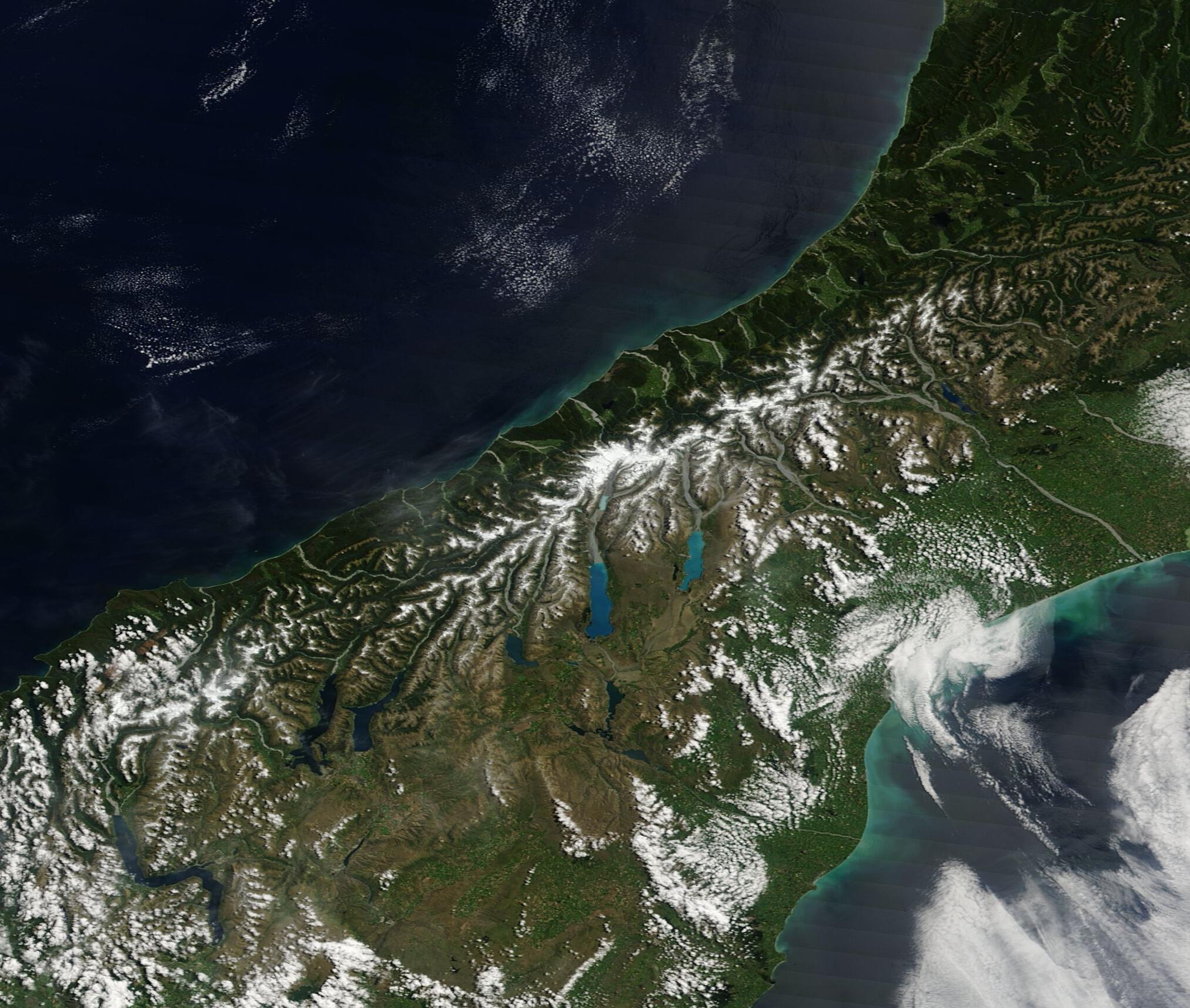
English: On December 26, 2022, the Moderate Resolution Imaging Spectroradiometer (MODIS) on board NASA’s Terra satellite acquired a true-color image of an early summer day in New Zealand.
Stretching hundreds of miles across New Zealand’s South Island, the Southern Alps form a spine of white that contrasts with the surrounding green and brown landscape. The highest peak in the mountain range, known as Aoraki Mount Cook, rises approximately 3,750 meters (12,300 feet) above sea level and appears as the brightest and largest area of snow atop the Southern Alps. The elevation of the range creates a rain-shadow effect east of the mountain range. The mountains and their foothills on the west side, which is also nearest the coastline, experience frequent rain and snowfall year-round, while the downwind (east side) of these peaks have a more arid climate and many cloud-free days. This difference is apparent in this image, with the coastal area (actually the west side of the island) covered with green vegetation while the opposite side is colored in tans. South Island is also marked by the Alpine Fault, the major surface expression of the boundary between the Indo-Australian and the Pacific tectonic plates. The central section of the fault runs the length of South Island. As the plates progressively converge, the Southern Alps should continue to rise skyward over time. |
||
| Date | Taken on 26 December 2022 | ||
| Source |
Southern Alps, South Island, New Zealand (direct link)
|
||
| Author | MODIS Land Rapid Response Team, NASA GSFC |
| This media is a product of the Terra mission Credit and attribution belongs to the mission team, if not already specified in the "author" row |
Licensing edit
.jpg&action=edit§ion=2)
| This file is in the public domain in the United States because it was solely created by NASA. NASA copyright policy states that "NASA material is not protected by copyright unless noted". (See Template:PD-USGov, NASA copyright policy page or JPL Image Use Policy.) | ||
 |
Warnings:
|
File history
Click on a date/time to view the file as it appeared at that time.
| Date/Time | Thumbnail | Dimensions | User | Comment | |
|---|---|---|---|---|---|
| current | 12:59, 8 August 2023 | | 2,024 × 1,714 (493 KB) | OptimusPrimeBot (talk | contribs) | #Spacemedia - Upload of http://modis.gsfc.nasa.gov/gallery/images/image01032023_250m.jpg via Commons:Spacemedia |
You cannot overwrite this file.
File usage on Commons
There are no pages that use this file.
.jpg&oldid=873062748)