File:Southern Shore of Marblehead Peninsula.jpg
Size of this preview: 800 × 600 pixels. Other resolutions: 320 × 240 pixels | 640 × 480 pixels | 1,024 × 768 pixels | 1,280 × 960 pixels | 2,560 × 1,920 pixels | 2,816 × 2,112 pixels.
Original file (2,816 × 2,112 pixels, file size: 2.05 MB, MIME type: image/jpeg)
Captions
Captions
Add a one-line explanation of what this file represents
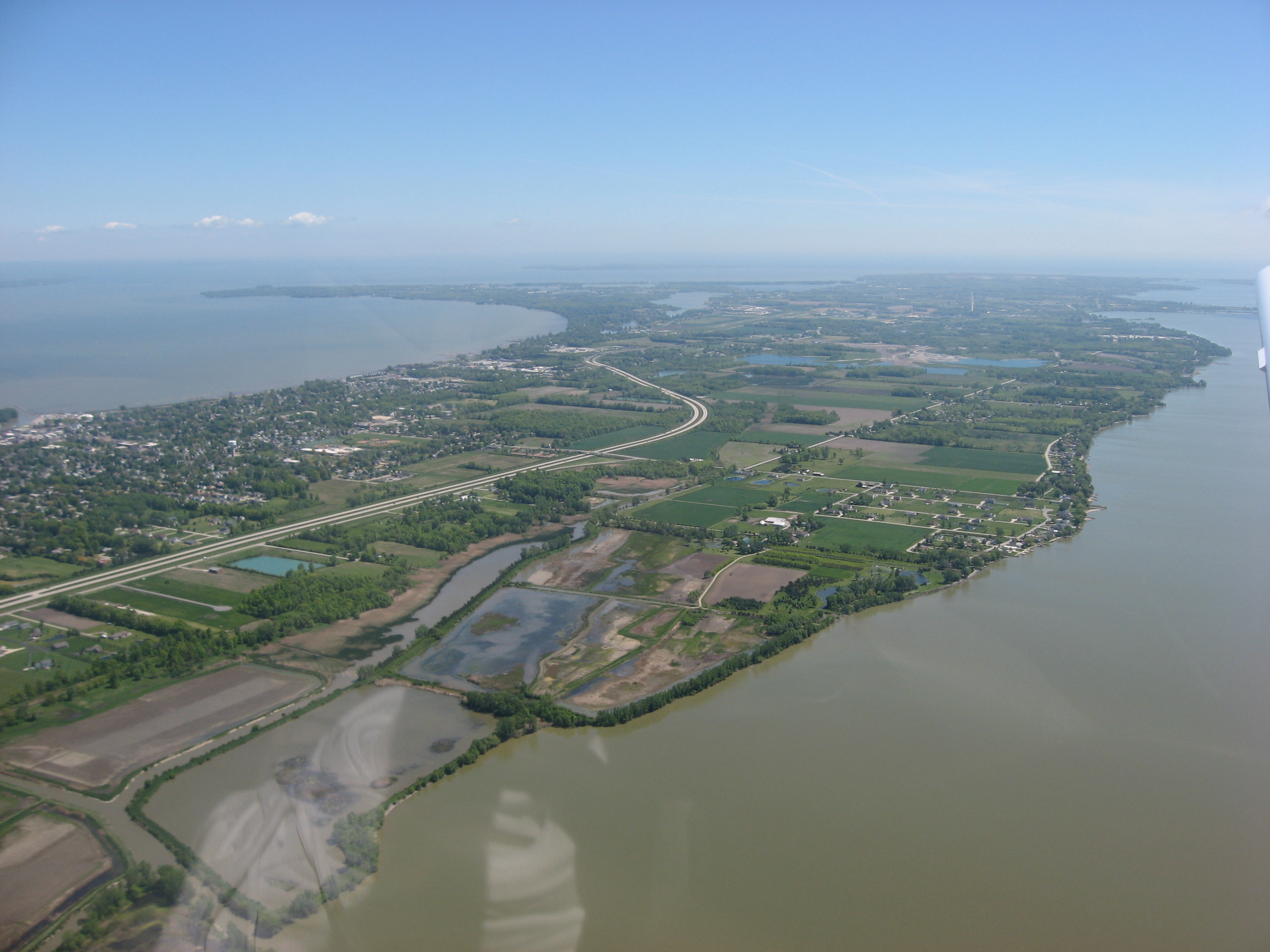
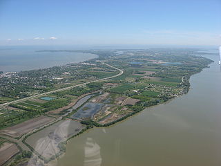
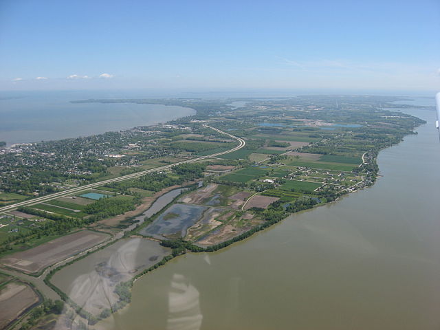
| Description | Aerial view of the western end of the Marblehead Peninsula in Portage Township, Ottawa County, Ohio, United States, with Port Clinton on the far left edge. Bodies of water are Sandusky Bay on the near side, and Lake Erie on the far side of the peninsula. Picture taken from a Diamond Eclipse light airplane at an altitude of 2,400 feet MSL and a bearing of approximately 90º. | ||
| Date | Taken on 24 May 2008 | ||
| Source | Own work | ||
| Author | Nyttend | ||
| Permission (Reusing this file) |
|
File history
Click on a date/time to view the file as it appeared at that time.
| Date/Time | Thumbnail | Dimensions | User | Comment | |
|---|---|---|---|---|---|
| current | 00:29, 16 August 2008 | | 2,816 × 2,112 (2.05 MB) | Nyttend (talk | contribs) | {{Information |Description=Aerial view of the western end of the {{w|Marblehead Peninsula}} in {{w|Portage Township, Ottawa County, Ohio|Portage Township}}, {{w|Ottawa County, Ohio|Ottawa County}}, {{w|Ohio}}, {{w|United States}}, with {{w|Port Clinton, O |
You cannot overwrite this file.
File usage on Commons
The following page uses this file:
File usage on other wikis
The following other wikis use this file:
- Usage on en.wikipedia.org
- Usage on es.wikipedia.org
- Usage on eu.wikipedia.org
- Usage on fa.wikipedia.org
- Usage on pt.wikipedia.org
- Usage on ur.wikipedia.org
- Usage on vi.wikipedia.org
- Usage on www.wikidata.org
- Usage on zh.wikipedia.org