File:Southern oregon cascades map.png
No higher resolution available.
Southern_oregon_cascades_map.png (593 × 557 pixels, file size: 24 KB, MIME type: image/png)
Captions
Captions
Add a one-line explanation of what this file represents
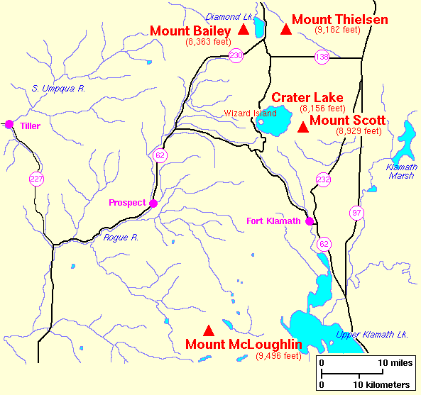
| Description | United States Geological Survey map of the southern Oregon Cascades. | |||
| Date | 1987, modified 1998 | |||
| Source | Archived source link | |||
| Author | Lyn Topinka, USGS | |||
| Permission (Reusing this file) |
|
|||
| Other versions |

File history
Click on a date/time to view the file as it appeared at that time.
| Date/Time | Thumbnail | Dimensions | User | Comment | |
|---|---|---|---|---|---|
| current | 06:51, 31 October 2007 | | 593 × 557 (24 KB) | Peteforsyth (talk | contribs) | crop out extraneous text |
| 11:07, 29 September 2007 |  | 618 × 624 (41 KB) | CarolSpears (talk | contribs) | {{Information |Description=United States Geological Survey map of the southern Oregon Cascades. |Source=w:Image:Southern oregon cascades map.pngSource URL: http://vulcan.wr.usgs.gov/Volcanoes/Oregon/Maps/map_southern_oregon_cascades.html |Date=07:23, |
You cannot overwrite this file.
File usage on Commons
The following page uses this file:
File usage on other wikis
The following other wikis use this file:
- Usage on es.wikipedia.org