File:Spaetroemisches Kastell Kellmuenz Plan.png
Size of this preview: 600 × 600 pixels. Other resolutions: 240 × 240 pixels | 480 × 480 pixels | 768 × 768 pixels | 1,024 × 1,024 pixels | 2,400 × 2,400 pixels.
Original file (2,400 × 2,400 pixels, file size: 546 KB, MIME type: image/png)
Captions
Captions
Add a one-line explanation of what this file represents
Summary
edit| Description |
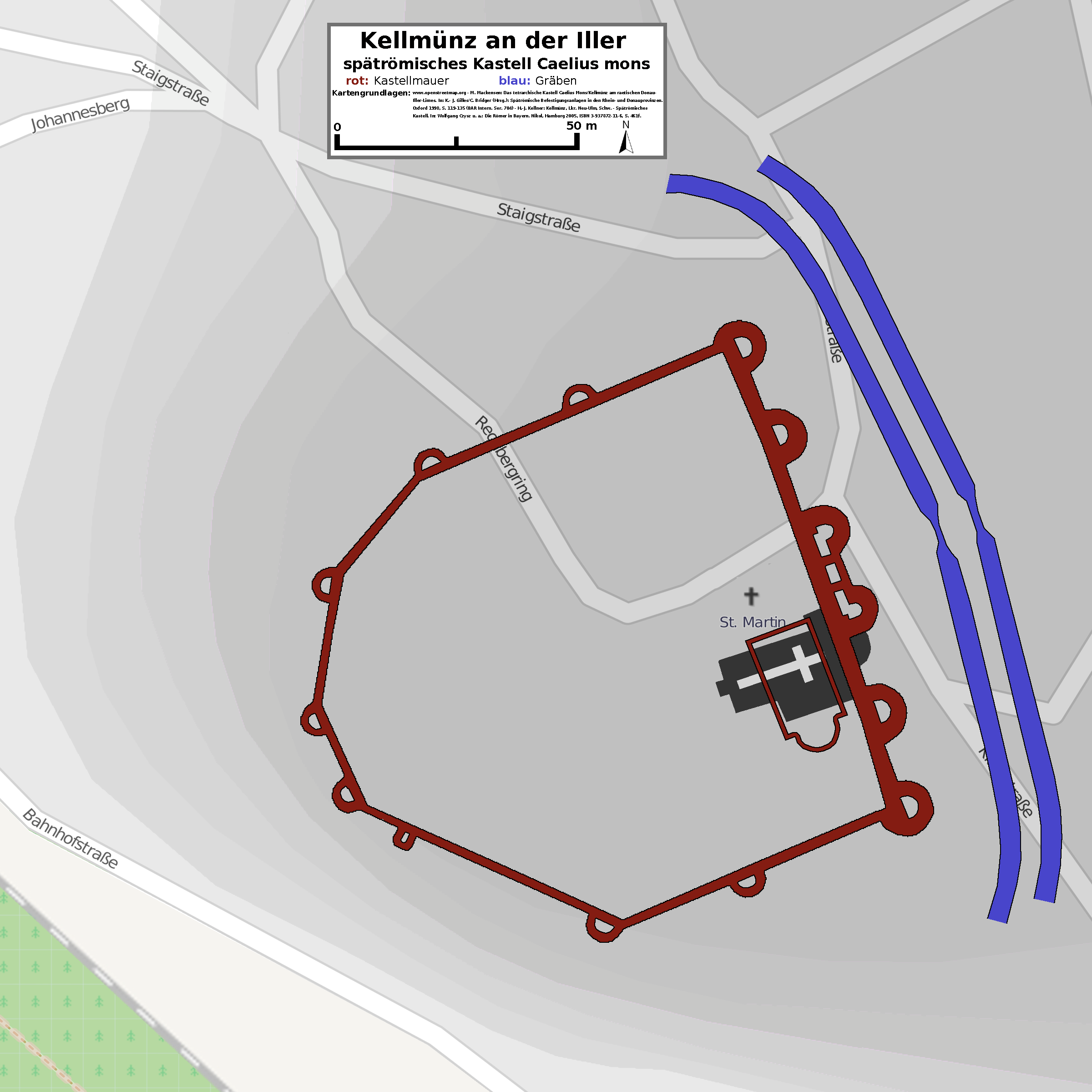
Deutsch: Lageplan des spätrömischen Kastell Kellmünz. |
||
| Date | |||
| Source | openstreetmap.org [1], Datei:Cella7.jpg, literature mentioned in the picture + own work. | ||
| Creator |
Contributors of the relevant openstreetmap.org data + Haselburg-müller |
||
| Georeferencing | If inappropriate please set warp_status = skip to hide. | ||
| Other versions |
|

Licensing
edit
I, the copyright holder of this work, hereby publish it under the following license:
This file is licensed under the Creative Commons Attribution-Share Alike 2.0 Generic license.
- You are free:
- to share – to copy, distribute and transmit the work
- to remix – to adapt the work
- Under the following conditions:
- attribution – You must give appropriate credit, provide a link to the license, and indicate if changes were made. You may do so in any reasonable manner, but not in any way that suggests the licensor endorses you or your use.
- share alike – If you remix, transform, or build upon the material, you must distribute your contributions under the same or compatible license as the original.
File history
Click on a date/time to view the file as it appeared at that time.
| Date/Time | Thumbnail | Dimensions | User | Comment | |
|---|---|---|---|---|---|
| current | 14:11, 31 December 2010 | | 2,400 × 2,400 (546 KB) | Lumpeseggl (talk | contribs) | {{Information |Description={{de|1=Lageplan des spätrömischen Kastell Kellmünz.}} |Source=openstreetmap.org [http://www.openstreetmap.org/?lat=48.12044&lon=10.12803&zoom=17&layers=M] + own work |Author=Contributors of the relevant o |
You cannot overwrite this file.
File usage on Commons
The following page uses this file:
File usage on other wikis
The following other wikis use this file:
- Usage on de.wikipedia.org
- Usage on fr.wikipedia.org
- Usage on it.wikipedia.org
- Usage on ro.wikipedia.org
- Usage on www.wikidata.org