File:Ssis InSAR may2001.jpg
Size of this preview: 738 × 599 pixels. Other resolutions: 296 × 240 pixels | 591 × 480 pixels | 946 × 768 pixels | 1,081 × 878 pixels.
Original file (1,081 × 878 pixels, file size: 197 KB, MIME type: image/jpeg)
Captions
Captions
Add a one-line explanation of what this file represents
Summary edit
| Description |
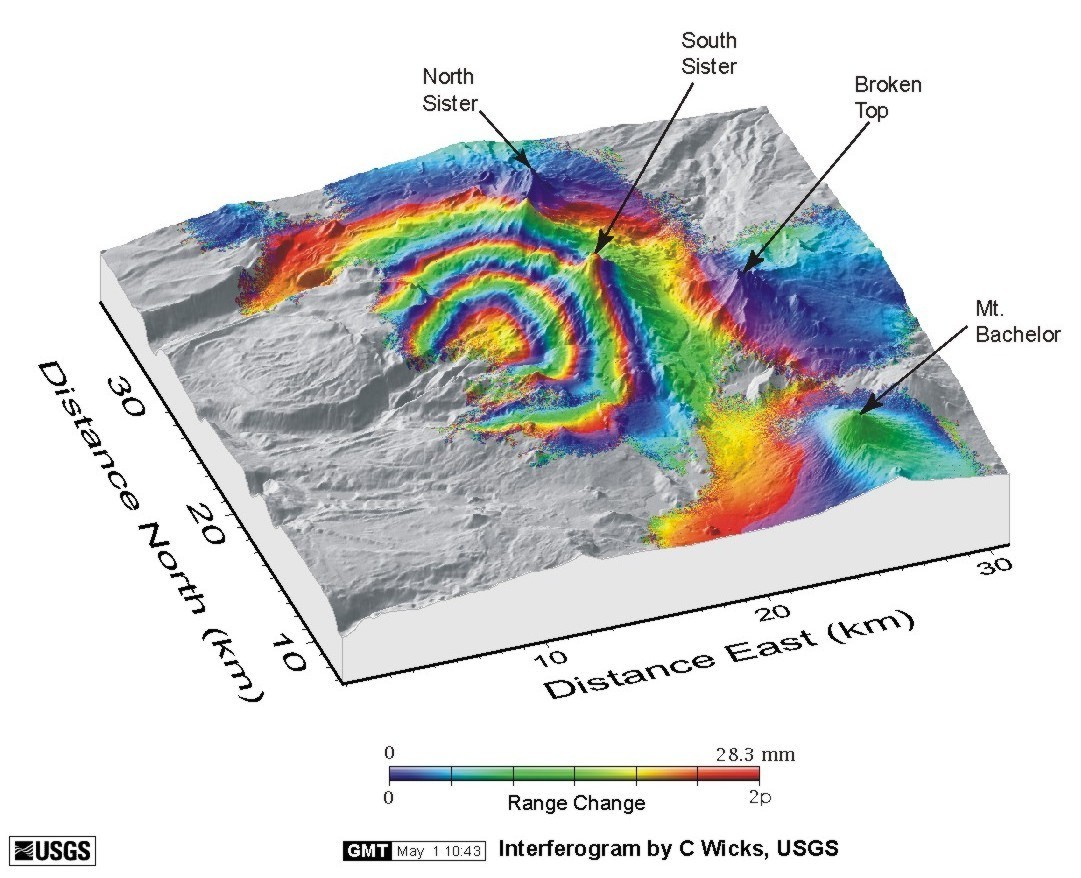
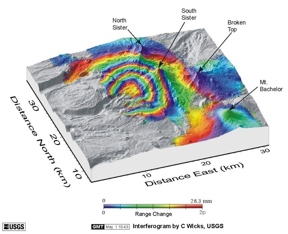
English: Ground uplift near the Three Sisters volcanic center, central Oregon Cascade Range, detected by satellite radar interferometry. |
| Date | |
| Source | http://vulcan.wr.usgs.gov/Imgs/Jpg/Sisters/WestUplift/ssis_InSAR_may2001.jpg |
| Author | en:United States Geological Survey |
| Permission (Reusing this file) |
PD-USGOV-INTERIOR-USGS. |
Licensing edit
This image is in the public domain in the United States because it only contains materials that originally came from the United States Geological Survey, an agency of the United States Department of the Interior. For more information, see the official USGS copyright policy.
|
File history
Click on a date/time to view the file as it appeared at that time.
| Date/Time | Thumbnail | Dimensions | User | Comment | |
|---|---|---|---|---|---|
| current | 17:37, 10 April 2013 | | 1,081 × 878 (197 KB) | Gemini1980 (talk | contribs) | User created page with UploadWizard |
You cannot overwrite this file.
File usage on Commons
The following page uses this file:
File usage on other wikis
The following other wikis use this file:
- Usage on fr.wikipedia.org
- Usage on it.wikipedia.org
- Usage on lv.wikipedia.org