File:St Mary's church, Ashby, Suffolk - geograph.org.uk - 1507376.jpg
Size of this preview: 467 × 599 pixels. Other resolutions: 187 × 240 pixels | 499 × 640 pixels.
Original file (499 × 640 pixels, file size: 87 KB, MIME type: image/jpeg)
Captions
Captions
Add a one-line explanation of what this file represents
Summary edit
| Description |
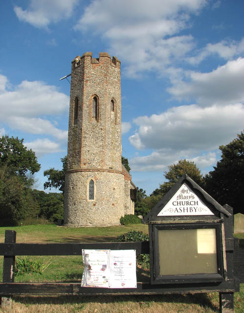
English: St Mary's parish church, Ashby, Suffolk, seen from the west |
| Date | |
| Source | From geograph.org.uk |
| Author | Evelyn Simak |
| Attribution (required by the license) | Evelyn Simak / St Mary's church / |
| Camera location | | View this and other nearby images on: OpenStreetMap |
|---|
_heading:90.00&language=en)
| Object location | | View this and other nearby images on: OpenStreetMap |
|---|
_heading:90.00&language=en)
Licensing edit

|
This image was taken from the Geograph project collection. See this photograph's page on the Geograph website for the photographer's contact details. The copyright on this image is owned by Evelyn Simak and is licensed for reuse under the Creative Commons Attribution-ShareAlike 2.0 license.
|
This file is licensed under the Creative Commons Attribution-Share Alike 2.0 Generic license.
Attribution: Evelyn Simak
- You are free:
- to share – to copy, distribute and transmit the work
- to remix – to adapt the work
- Under the following conditions:
- attribution – You must give appropriate credit, provide a link to the license, and indicate if changes were made. You may do so in any reasonable manner, but not in any way that suggests the licensor endorses you or your use.
- share alike – If you remix, transform, or build upon the material, you must distribute your contributions under the same or compatible license as the original.
File history
Click on a date/time to view the file as it appeared at that time.
| Date/Time | Thumbnail | Dimensions | User | Comment | |
|---|---|---|---|---|---|
| current | 21:49, 2 March 2011 | | 499 × 640 (87 KB) | GeographBot (talk | contribs) | == {{int:filedesc}} == {{Information |description={{en|1=St Mary's church Ashby is a small hamlet located on the Suffolk/Norfolk border. St Mary's church stands isolated surrounded by farmland about 0.4 mile south of a small, dispersed cluster of houses, |
You cannot overwrite this file.
File usage on Commons
The following page uses this file:
- File:St Mary's church - geograph.org.uk - 1507376.jpg (file redirect)