File:Stadtgliederung Remscheid (SVG Version).svg

Size of this PNG preview of this SVG file: 800 × 566 pixels. Other resolutions: 320 × 226 pixels | 640 × 452 pixels | 1,024 × 724 pixels | 1,280 × 905 pixels | 2,560 × 1,810 pixels | 1,488 × 1,052 pixels.
Original file (SVG file, nominally 1,488 × 1,052 pixels, file size: 197 KB)
Captions
Captions
Add a one-line explanation of what this file represents
Summary
edit.svg&action=edit§ion=1)
| Description |
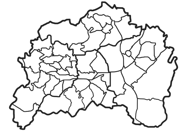
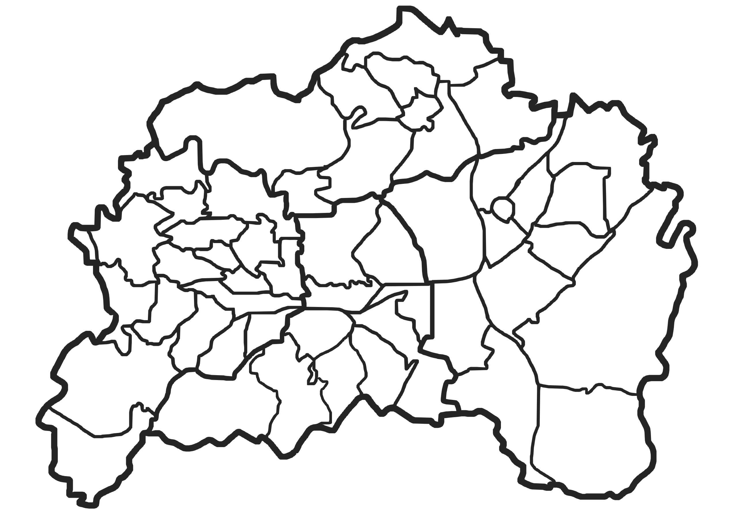
Deutsch: Stadtgliederung Remscheid, SVG Version |
| Date | |
| Source |
 |
| Author | User:Johannes1024 |
Licensing
edit.svg&action=edit§ion=2)
This file is licensed under the Creative Commons Attribution-Share Alike 3.0 Unported license.
- You are free:
- to share – to copy, distribute and transmit the work
- to remix – to adapt the work
- Under the following conditions:
- attribution – You must give appropriate credit, provide a link to the license, and indicate if changes were made. You may do so in any reasonable manner, but not in any way that suggests the licensor endorses you or your use.
- share alike – If you remix, transform, or build upon the material, you must distribute your contributions under the same or compatible license as the original.
File history
Click on a date/time to view the file as it appeared at that time.
| Date/Time | Thumbnail | Dimensions | User | Comment | |
|---|---|---|---|---|---|
| current | 19:17, 4 January 2015 | | 1,488 × 1,052 (197 KB) | Morty (talk | contribs) | User created page with UploadWizard |
You cannot overwrite this file.
File usage on Commons
There are no pages that use this file.
File usage on other wikis
The following other wikis use this file:
- Usage on de.wikipedia.org
- Bergisch Born
- Farrenbracken
- Langenhaus
- Kräwinklerbrücke
- Liste der Stadtbezirke und Stadtteile von Remscheid
- Mebusmühle
- Leyermühle
- Westen (Remscheid)
- Clemenshammer
- Clarenbach (Remscheid)
- Stollen (Remscheid)
- Halbach (Remscheid)
- Heusiepen (Remscheid)
- Grund (Remscheid)
- Gerstau
- Platz (Remscheid)
- Gründerhammer
- Aue (Remscheid)
- Spelsberg
- Spelsberger Hammer
- Oelingrath
- Wüste (Remscheid)
- Birgden III
- Grüne (Remscheid)
- Neuland (Remscheid)
- Flügel (Remscheid)
- Leverkusen (Remscheid)
- Fürberg (Remscheid)
- Güldenwerth
- Panzer (Remscheid)
- Baisiepen
- Nüdelshalbach
- Birgden I
- Kranenholl
- Hermannsmühle (Lüttringhausen)
- Blume (Remscheid)
- Sonnenschein (Remscheid)
- Siepen (Lennep)
- Bornbach (Remscheid)
- Vorlage:Positionskarte Deutschland NRW Remscheid
- Bornefeld (Remscheid)
- Tefental
- Oberlangenbach
- Niederlangenbach
- Heydt (Remscheid)
- Engelsburg (Remscheid)
- Rademachershof
- Lüdorf (Remscheid)
- Repslöh
- Dörpholz
View more global usage of this file.
.svg)
.svg&oldid=478825689)