File:Stagbatch House - geograph.org.uk - 360767 (cropped).jpg
No higher resolution available.
Stagbatch_House_-_geograph.org.uk_-_360767_(cropped).jpg (313 × 313 pixels, file size: 59 KB, MIME type: image/jpeg)
Captions
Captions
Add a one-line explanation of what this file represents
Summary
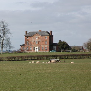
edit| Description |
English: Stagbatch House Stagbatch House overlooks the A44 about 1 mile to the east of Monkland. |
| Date | |
| Source |
This file was derived from: Stagbatch House - geograph.org.uk - 360767.jpg by Saga City |
| Author | Philip Halling |
| Other versions |

.jpg&action=edit§ion=1)
| Camera location | | View this and other nearby images on: OpenStreetMap |
|---|
.jpg¶ms=052.220853_N_-002.782082_E_globe:Earth_type:camera_heading:315.00&language=en)
Licensing
edit.jpg&action=edit§ion=2)
This file is licensed under the Creative Commons Attribution-Share Alike 2.0 Generic license.
Attribution: Philip Halling
- You are free:
- to share – to copy, distribute and transmit the work
- to remix – to adapt the work
- Under the following conditions:
- attribution – You must give appropriate credit, provide a link to the license, and indicate if changes were made. You may do so in any reasonable manner, but not in any way that suggests the licensor endorses you or your use.
- share alike – If you remix, transform, or build upon the material, you must distribute your contributions under the same or compatible license as the original.
.jpg&action=edit&withJS=MediaWiki:Catcheck.js)
- Remove redundant categories and try to put this image in the most specific category/categories
- Remove this template
- The location categories are based on information from this geonames tool and this OpenStreetMap tool combined with a database. You can also have a look at this tool from mysociety.
- The topic category from Geograph was Country house (find similar images house at Geograph)
File history
Click on a date/time to view the file as it appeared at that time.
| Date/Time | Thumbnail | Dimensions | User | Comment | |
|---|---|---|---|---|---|
| current | 07:52, 28 November 2015 | | 313 × 313 (59 KB) | Saga City (talk | contribs) | File:Stagbatch House - geograph.org.uk - 360767.jpg cropped 51 % horizontally and 27 % vertically using CropTool with precise mode. |
You cannot overwrite this file.
File usage on Commons
There are no pages that use this file.
.jpg&oldid=717319606)