File:Staplehill Road bends southeast - geograph.org.uk - 1723951.jpg

Size of this preview: 800 × 600 pixels. Other resolutions: 320 × 240 pixels | 640 × 480 pixels | 1,024 × 768 pixels | 1,280 × 960 pixels | 2,560 × 1,920 pixels | 3,264 × 2,448 pixels.
Original file (3,264 × 2,448 pixels, file size: 5.79 MB, MIME type: image/jpeg)
Captions
Captions
Add a one-line explanation of what this file represents
Summary
edit
| Description |
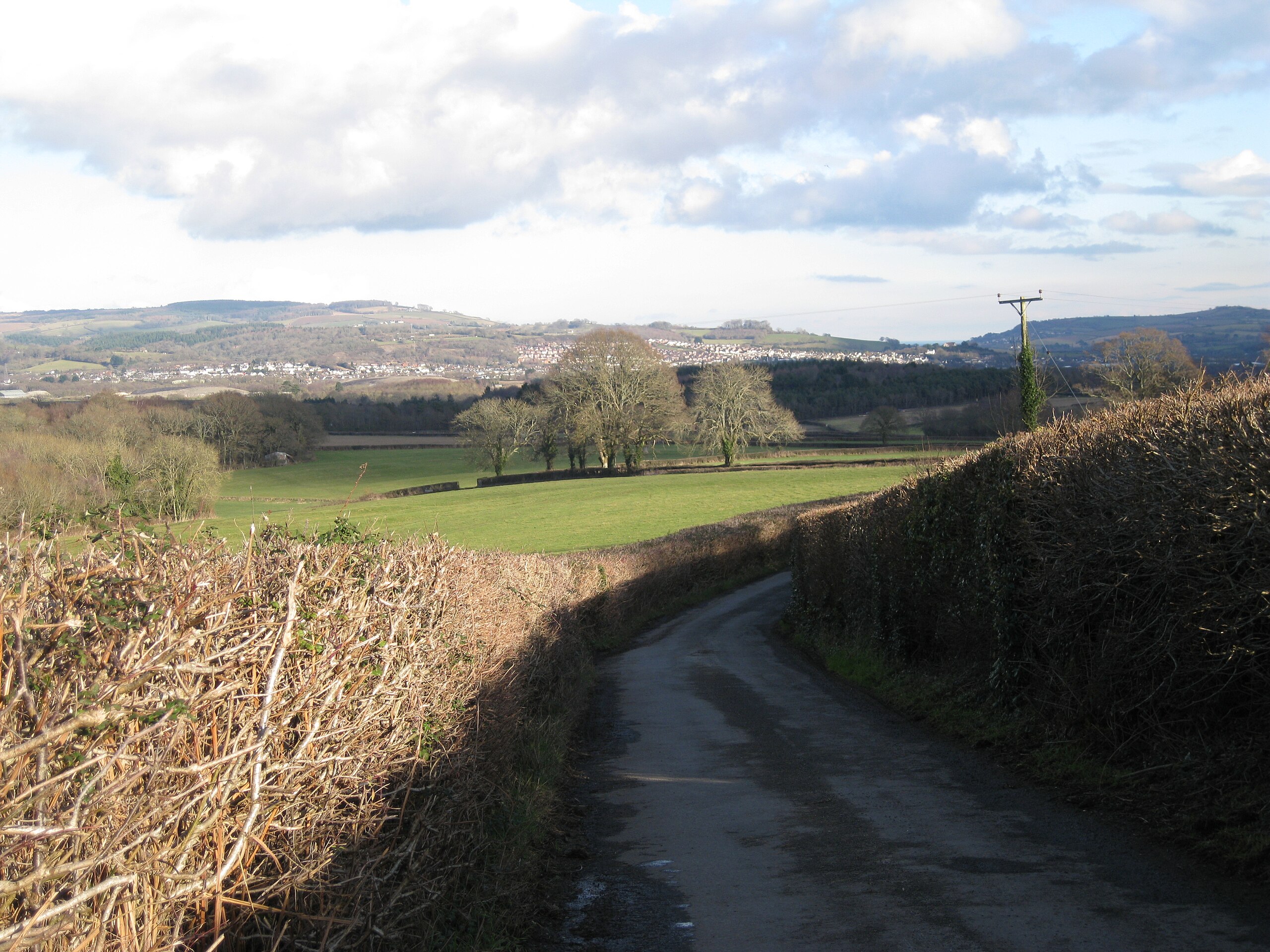
English: Staplehill Road bends southeast. The group of trees is by a public footpath between Ashill and Stover 87254. The conifer plantation behind them lies between Greycoat Lane and Stover Quarry, all out of sight in SX8473. Beyond that is Kingsteignton spread out in the sun SX8773. On the skyline, left, is Little Haldon SX9176. On the right, in shadow, are the hills south of Shaldon SX9371. |
| Date | |
| Source | From geograph.org.uk |
| Author | Robin Stott |
| Attribution (required by the license) | Robin Stott / Staplehill Road bends southeast / |
| Camera location | | View this and other nearby images on: OpenStreetMap |
|---|
_heading:90.00&language=en)
| Object location | | View this and other nearby images on: OpenStreetMap |
|---|
_heading:90.00&language=en)
Licensing
edit

|
This image was taken from the Geograph project collection. See this photograph's page on the Geograph website for the photographer's contact details. The copyright on this image is owned by Robin Stott and is licensed for reuse under the Creative Commons Attribution-ShareAlike 2.0 license.
|
This file is licensed under the Creative Commons Attribution-Share Alike 2.0 Generic license.
Attribution: Robin Stott
- You are free:
- to share – to copy, distribute and transmit the work
- to remix – to adapt the work
- Under the following conditions:
- attribution – You must give appropriate credit, provide a link to the license, and indicate if changes were made. You may do so in any reasonable manner, but not in any way that suggests the licensor endorses you or your use.
- share alike – If you remix, transform, or build upon the material, you must distribute your contributions under the same or compatible license as the original.
File history
Click on a date/time to view the file as it appeared at that time.
| Date/Time | Thumbnail | Dimensions | User | Comment | |
|---|---|---|---|---|---|
| current | 13:00, 5 March 2011 | | 3,264 × 2,448 (5.79 MB) | GeographBot (talk | contribs) | == {{int:filedesc}} == {{Information |description={{en|1=Staplehill Road bends southeast The group of trees is by a public footpath between Ashill and Stover 87254. The conifer plantation behind them lies between Greycoat Lane and Stover Quarry, all o |
You cannot overwrite this file.
File usage on Commons
There are no pages that use this file.