File:Stary Dzedzin 17th Century be.png

Size of this preview: 797 × 599 pixels. Other resolutions: 319 × 240 pixels | 638 × 480 pixels | 1,021 × 768 pixels | 1,210 × 910 pixels.
Original file (1,210 × 910 pixels, file size: 71 KB, MIME type: image/png)
Captions
Captions
Add a one-line explanation of what this file represents
Summary edit
| Description |
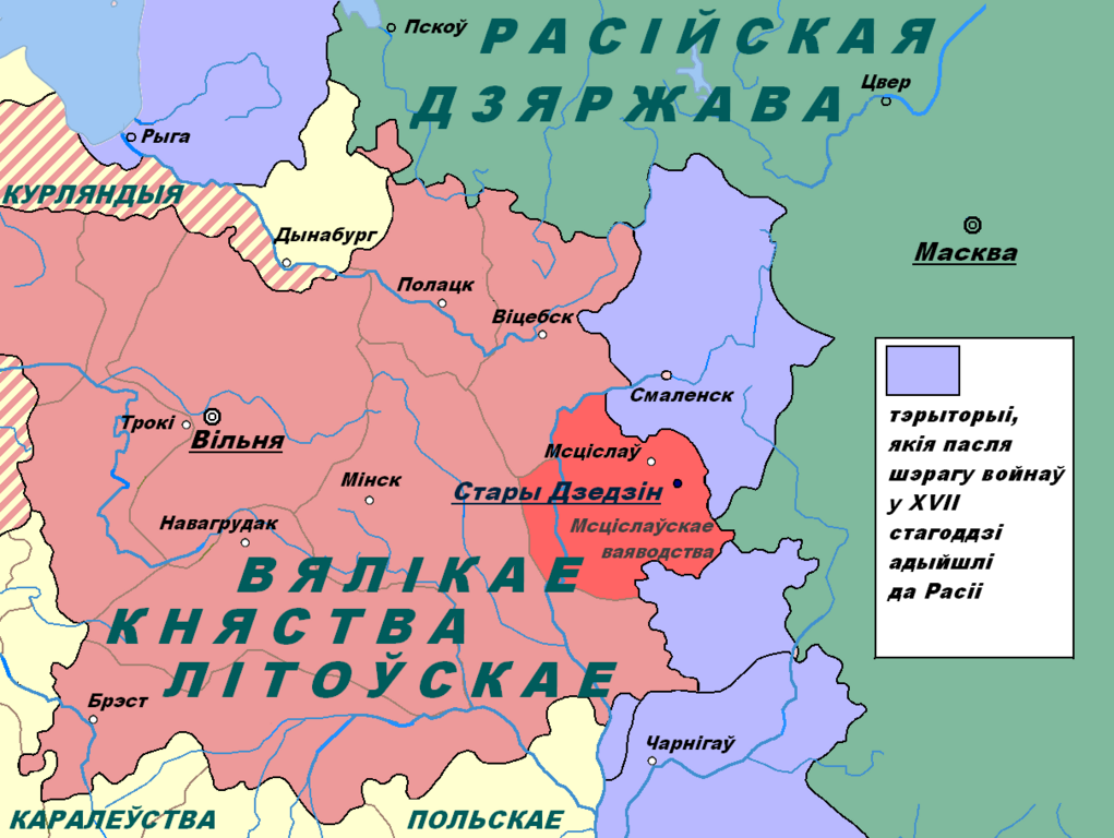
English: This image shows the location of the village Stary Dzedzin on the political map of the 17th century.
Беларуская: Гэтая выява паказвае месцазнаходжанне вёскі Стары Дзедзін на палітычнай карце XVII стагоддзя.
Русский: Это изображение показывает местонахождение деревни Старый Дедин на политической карте XVII века. |
| Date | |
| Source | Own work |
| Author | Игорь Авласенко |
Licensing edit
| I, the copyright holder of this work, release this work into the public domain. This applies worldwide. In some countries this may not be legally possible; if so: I grant anyone the right to use this work for any purpose, without any conditions, unless such conditions are required by law. |
File history
Click on a date/time to view the file as it appeared at that time.
| Date/Time | Thumbnail | Dimensions | User | Comment | |
|---|---|---|---|---|---|
| current | 20:11, 14 January 2011 | | 1,210 × 910 (71 KB) | Игорь Авласенко (talk | contribs) | {{Information |Description={{en|1=This image shows the location of the village Stary Dzedzin on the political map of the 17th century.}} {{be|1=Гэтая выява паказвае месцазнаходжанне вёскі Стары Дзедзін н |
You cannot overwrite this file.
File usage on Commons
There are no pages that use this file.
File usage on other wikis
The following other wikis use this file:
- Usage on be.wikipedia.org