File:Statdplan von Schorndorf (1832).gif

Size of this preview: 531 × 600 pixels. Other resolutions: 212 × 240 pixels | 425 × 480 pixels | 680 × 768 pixels | 1,024 × 1,157 pixels.
Original file (1,024 × 1,157 pixels, file size: 195 KB, MIME type: image/gif)
Captions
Captions
Add a one-line explanation of what this file represents
Summary
edit.gif&action=edit§ion=1)
| Description |
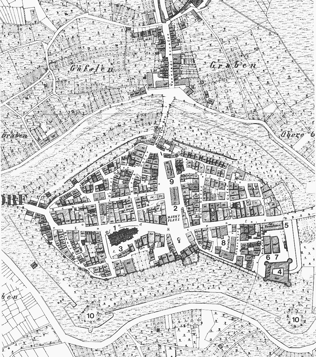
Deutsch: Karte von Schorndorf, Ausschnitt. In der Bildmitte die evangelische Stadtkirche (früher: Unserer Lieben Frau). |
| Date | |
| Source | kirchbau.de - Datenblatt | Bildergalerie | Direktlink |
| Author | Unknown author |
| Kirchen-ID | 3659 |
| Object location | | View this and other nearby images on: OpenStreetMap |
|---|
.gif¶ms=048.805054_N_0009.526003_E_globe:Earth_class:object_type:object__&language=en)
This media file was collected by kirchbau.de under the church ID 3659. This tag does not indicate the copyright status of the attached work. A normal copyright tag is still required. See Commons:Licensing. |
Licensing
edit.gif&action=edit§ion=2)
|
This work is in the public domain in its country of origin and other countries and areas where the copyright term is the author's life plus 100 years or fewer. This work is in the public domain in the United States because it was published (or registered with the U.S. Copyright Office) before January 1, 1929. | |
| This file has been identified as being free of known restrictions under copyright law, including all related and neighboring rights. | |
File history
Click on a date/time to view the file as it appeared at that time.
| Date/Time | Thumbnail | Dimensions | User | Comment | |
|---|---|---|---|---|---|
| current | 21:03, 22 November 2021 | | 1,024 × 1,157 (195 KB) | Laserlicht (talk | contribs) | =={{int:filedesc}}== {{Information |description={{de|1=evang. Stadtkirche (früher: Unserer Lieben Frau)}} |date= |source=[https://www.kirchbau.de kirchbau.de] - [https://www.kirchbau.de/300_datenblatt.php?id=3659&name=keiner Datenblatt] <nowiki>|</nowiki> [https://www.kirchbau.de/305_iframe_bildvorschau.php?id=3659 Bildergalerie] <nowiki>|</nowiki> [https://www.kirchbau.de/bildorig/s/schorndorf_stadtkirche_stadtgrundriss1832_1024x1157.gif Direktlink] |author=kirchbau.de |permission=CC BY 3.0... |
You cannot overwrite this file.
File usage on Commons
There are no pages that use this file.
.gif&oldid=798274622)